
Scheduled Maintenance
This website will undergo scheduled maintenance on Tuesday, August 6th, between 11:00 and 15:00, as well as on Thursday, August 8th, between 10:00 and 12:00.
During this time, services may be temporarily disrupted.
We apologise for any inconvenience.
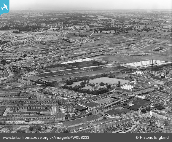
EPW058233 ENGLAND (1938). The Daimler Motor Car Works, Radford, from the south-east, 1938
© Copyright OpenStreetMap contributors and licensed by the OpenStreetMap Foundation. 2024. Cartography is licensed as CC BY-SA.
Nearby Images (17)
EPW058233

EPW027075

EPW027068

EPW027070

EPW027076

EPW027072

EPW027074

EPW027067

EPW050270

EPW050265

EPW050268

EPW050271

EPW050269

EPW027071

EPW050273

EPW050272

EPW050267

Details
| Title | [EPW058233] The Daimler Motor Car Works, Radford, from the south-east, 1938 |
| Reference | EPW058233 |
| Date | 26-July-1938 |
| Link | |
| Place name | RADFORD |
| Parish | |
| District | |
| Country | ENGLAND |
| Easting / Northing | 433465, 280404 |
| Longitude / Latitude | -1.5078612467931, 52.420226270385 |
| National Grid Reference | SP335804 |
Pins
 NottmJas |
Wednesday 31st of January 2024 12:40:44 PM | |
NottmJas |
Wednesday 31st of January 2024 12:39:00 PM | |
NottmJas |
Wednesday 31st of January 2024 12:38:24 PM | |
JL |
Friday 18th of February 2022 10:28:20 AM | |
John |
Sunday 1st of September 2019 11:32:04 AM | |
John W |
Tuesday 18th of October 2016 03:52:12 PM |