
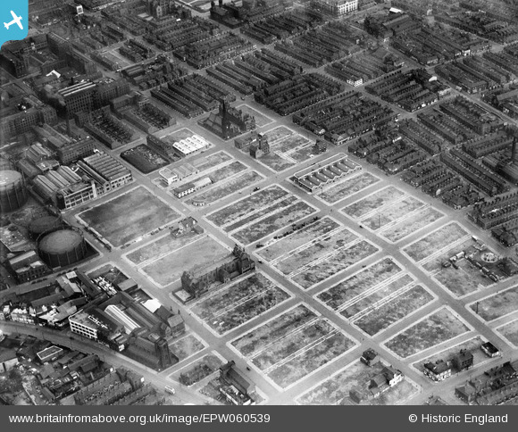
EPW060539 ENGLAND (1939). Slum clearance around George Street and environs, Manchester, 1939
© Copyright OpenStreetMap contributors and licensed by the OpenStreetMap Foundation. 2024. Cartography is licensed as CC BY-SA.
Nearby Images (5)
EPW060539

EPW017524

EPW055076

EPW062710

EPW062699

Details
| Title | [EPW060539] Slum clearance around George Street and environs, Manchester, 1939 |
| Reference | EPW060539 |
| Date | 14-February-1939 |
| Link | |
| Place name | MANCHESTER |
| Parish | |
| District | |
| Country | ENGLAND |
| Easting / Northing | 383716, 397118 |
| Longitude / Latitude | -2.2453428960242, 53.4702924299 |
| National Grid Reference | SJ837971 |
Pins
 Sloopy |
Tuesday 8th of March 2022 11:50:07 AM |