
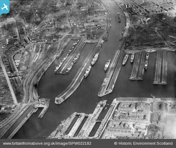
SPW022182 SCOTLAND (1928). Queen's Dock and Prince's Dock, Glasgow. An oblique aerial photograph taken facing east.
© Copyright OpenStreetMap contributors and licensed by the OpenStreetMap Foundation. 2024. Cartography is licensed as CC BY-SA.
Nearby Images (21)
SPW022182

SPW022184

SPW027221

SPW022179

SAR008788

SAR008790

SAR014705

SAR014707

SAR014709

SAR014713

SAR014774

SAR014826

SAR014832

SAR015079

SPW020708

SAW017939

SPW045884

SPW027231

SPW050833

SPW022255

SPW045889

Details
| Title | [SPW022182] Queen's Dock and Prince's Dock, Glasgow. An oblique aerial photograph taken facing east. |
| Reference | SPW022182 |
| Date | 1928 |
| Link | Canmore Collection item 1256541 |
| Place name | |
| Parish | GLASGOW (CITY OF GLASGOW) |
| District | CITY OF GLASGOW |
| Country | SCOTLAND |
| Easting / Northing | 256700, 665300 |
| Longitude / Latitude | -4.2898129423676, 55.859583663304 |
| National Grid Reference | NS567653 |
Pins
Be the first to add a comment to this image!