
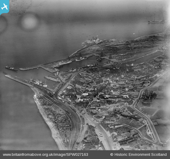
SPW027163 SCOTLAND (1929). Bo'ness, general view, showing Harbour, Dock and Stewart Avenue. An oblique aerial photograph taken facing east.
© Copyright OpenStreetMap contributors and licensed by the OpenStreetMap Foundation. 2024. Cartography is licensed as CC BY-SA.
Nearby Images (7)
SPW027163

SPW027161

SPW027166

SPW027160

SPW027158

SPW027165

SPW027159

Details
| Title | [SPW027163] Bo'ness, general view, showing Harbour, Dock and Stewart Avenue. An oblique aerial photograph taken facing east. |
| Reference | SPW027163 |
| Date | 1929 |
| Link | Canmore Collection item 1256737 |
| Place name | |
| Parish | BO'NESS AND CARRIDEN |
| District | FALKIRK |
| Country | SCOTLAND |
| Easting / Northing | 299988, 681783 |
| Longitude / Latitude | -3.604586629925, 56.018562198401 |
| National Grid Reference | NS1000818 |
Pins
Be the first to add a comment to this image!


