
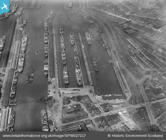
SPW027217 SCOTLAND (1929). Queen's Dock, Glasgow. An oblique aerial photograph taken facing west.
© Copyright OpenStreetMap contributors and licensed by the OpenStreetMap Foundation. 2024. Cartography is licensed as CC BY-SA.
Nearby Images (11)
SPW027217

SPW050835

SPW027219

SPW027226

SAW017939

SPW045884

SAW017938

SPW020707

SPW027218

SPW027220

SPW022179

Details
| Title | [SPW027217] Queen's Dock, Glasgow. An oblique aerial photograph taken facing west. |
| Reference | SPW027217 |
| Date | 1929 |
| Link | Canmore Collection item 1256791 |
| Place name | |
| Parish | GLASGOW (CITY OF GLASGOW) |
| District | CITY OF GLASGOW |
| Country | SCOTLAND |
| Easting / Northing | 257050, 665340 |
| Longitude / Latitude | -4.2842463212622, 55.860046692489 |
| National Grid Reference | NS571653 |
Pins
 JIM |
Tuesday 8th of December 2015 10:12:16 PM | |
JIM |
Tuesday 8th of December 2015 10:10:21 PM | |
JIM |
Tuesday 8th of December 2015 10:08:52 PM | |
JIM |
Tuesday 8th of December 2015 10:08:03 PM | |
JIM |
Tuesday 8th of December 2015 10:06:52 PM | |
JIM |
Tuesday 8th of December 2015 09:56:03 PM | |
JIM |
Tuesday 8th of December 2015 09:44:48 PM | |
JIM |
Tuesday 8th of December 2015 09:43:11 PM |