
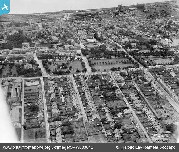
SPW033641 SCOTLAND (1930). Montrose, general view, showing Mid Links and Union Road. An oblique aerial photograph taken facing west.
© Copyright OpenStreetMap contributors and licensed by the OpenStreetMap Foundation. 2024. Cartography is licensed as CC BY-SA.
Nearby Images (4)
SPW033641

SPW040583

SPW033637

SPW040584

Details
| Title | [SPW033641] Montrose, general view, showing Mid Links and Union Road. An oblique aerial photograph taken facing west. |
| Reference | SPW033641 |
| Date | 1930 |
| Link | Canmore Collection item 1256992 |
| Place name | |
| Parish | MONTROSE |
| District | ANGUS |
| Country | SCOTLAND |
| Easting / Northing | 371748, 757853 |
| Longitude / Latitude | -2.4615530690731, 56.711648187533 |
| National Grid Reference | NO717579 |
Pins
 ianADL |
Friday 18th of March 2022 03:31:40 PM | |
 Class31 |
Tuesday 19th of February 2013 10:43:58 PM | |
Class31 |
Tuesday 19th of February 2013 10:43:03 PM | |
Class31 |
Tuesday 19th of February 2013 10:42:20 PM | |
Class31 |
Tuesday 19th of February 2013 10:47:29 AM | |
Class31 |
Tuesday 19th of February 2013 10:47:01 AM | |
Class31 |
Tuesday 19th of February 2013 10:46:30 AM | |
Class31 |
Tuesday 19th of February 2013 10:46:09 AM | |
Class31 |
Tuesday 19th of February 2013 10:45:34 AM |