
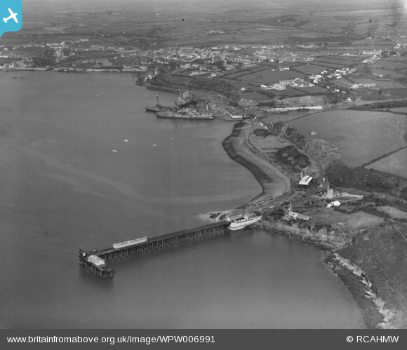
WPW006991 WALES (1921). View of Milford Haven, oblique aerial view. 5"x4" black and white glass plate negative.
© Copyright OpenStreetMap contributors and licensed by the OpenStreetMap Foundation. 2024. Cartography is licensed as CC BY-SA.
Nearby Images (24)
WPW006984

WPW006985

WPW006986

WPW006987

WPW006988

WPW006989

WPW006990

WPW006991

WPW006992

WPW006993

WPW006994

WPW006995

WPW029623

WPW029624

WPW029633

WPW029634

WPW029635

WPW029636

WPW029637

WPW029639

WPW029641

WPW029642

WPW029644

WPW029645

Details
| Title | [WPW006991] View of Milford Haven, oblique aerial view. 5"x4" black and white glass plate negative. |
| Reference | WPW006991 |
| Date | 1921 |
| Link | Coflein Archive Item 6370355 |
| Place name | |
| Parish | |
| District | |
| Country | WALES |
| Easting / Northing | 190303, 205971 |
| Longitude / Latitude | -5.0357893607148, 51.712751699674 |
| National Grid Reference | SM903060 |
Pins
Be the first to add a comment to this image!
User Comment Contributions
The jetty in the foreground is the Newton Noyes pier which was the loading and landing stage for the Royal Naval Armaments Depot Milford Haven. The main task of this depot was the maintenance and storage of sea mines. |
 Adrian James |
Saturday 31st of August 2013 10:37:35 AM |