Grwpiau
Weather
About the group Images showing the impact of climactic changes
Wedi ei greu 5 December 2012

AlMu |
||
|
Bright sunshine is one of the things we all love about summer, but it can pose problems many ways. The sharp shadows in this image show the strength off the sunshine, but we can also see how its oblique angle is casting a shadow over the road behind. This can be hazardous for drivers as they move out of shadow into bright light and are temporarily dazzled, or are momentarily unable to see clearly when they move from bright light back into shade.
|

AlMu |
|
|
Ben Nevis is the highest mountain in Britain, rising for more than 4,400 feet near to Fort William, in the Lochaber area of the Scottish Highlands.
Its height means that it is often shrouded in mist and rain (one interpretation of the meaning of its name is 'mountain with its head in the clouds'). The high volume of precipitation creates many run-off channels for water to drain from the higher to the lower slopes and eventually to the River Nevis below. These can be seen clearly in the image, and are a good example of how erosion by the weather gradually carries material from upper to lower slopes, playing a significant role - over very long periods of time - is shaping the landscape around us. |

AlMu |
|
|
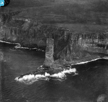
The impact of the weather on the land creates erosion, which - although it is slow - is one of the most powerful forces which shape the world that we see today.
The Old Man of Hoy rises for nearly 450 feet off the West coast of the island of Hoy, which is part of the Orkney Islands archipelago. The Old May is a good example of a 'sea-stack' - that is, a column of rock which was originally part of the mainland behind it, but which has been eroded by the sea. This first forms a natural rock arch and then (when the roof of the arch collapses)leaves behind the outer buttress of the arch as a sea-stack, as we see here. Other Scottish examples include the Old Man of Stoer and Am Buchaille in Sandwood Bay, both off the West coast of Sutherland |

AlMu |
|
|
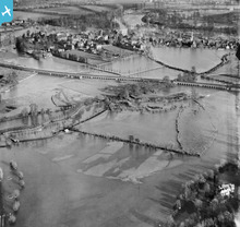
The Eton Railway viaduct carries the Great Western Railway (GWR) past Eton and Eton School in Berkshire. It is clear that Brunel knew that this part of the Thames was prone to flooding when he designed the railway. The viaduct is one of the few structures above the water.
|

MM |
|
|
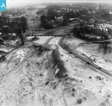
These artificial looking mounds, in this suburb of London, are providing ideal slopes for people to sledge down. The crowds of people suggest it was a weekend or maybe the schools were closed.
|

MM |
|
|
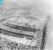
In the late 1920s and 30s many towns were expanding in to the countryside around as inner city slums were demolished and people needed to be rehoused. These semi detached houses in Sheffield, with long gardens, are typical of the planned new housing estates of this period. The snow is melting in interesting patterns on the roofs of the houses.
|

MM |
|
|
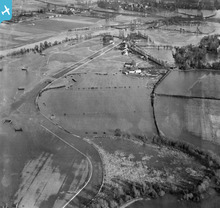
You can see the race track and jumps sticking out of the water. Flood defences including the Thames Barrier have been built since the 1920s as the Thames floods could have flooded large areas of London.
|

MM |
|
|
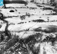
If you look really closely can just make out the people sledging and playing in the snow. Much of this area now appears to have been built on - but there is still a park and playing field.
|

Cat |
|
|
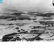
The Ochil Hills rise to over 2,000 feet, taking them well above the freezing level on most days throughout the winter.
|

AlMu |
|
 |

AlMu |



see image record