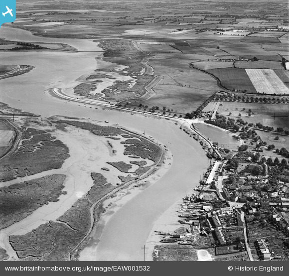
EAW001532 ENGLAND (1946). The River Blackwater at The Hythe, Maldon, from the north-west, 1946
© Hawlfraint cyfranwyr OpenStreetMap a thrwyddedwyd gan yr OpenStreetMap Foundation. 2025. Trwyddedir y gartograffeg fel CC BY-SA.
Delweddau cyfagos (7)
EAW001532

EAW021829

EAW021830

EAW043493

EAW021833

EPW054678

EPW054680

Manylion
| Pennawd | [EAW001532] The River Blackwater at The Hythe, Maldon, from the north-west, 1946 |
| Cyfeirnod | EAW001532 |
| Dyddiad | 5-July-1946 |
| Dolen | |
| Enw lle | MALDON |
| Plwyf | MALDON |
| Ardal | |
| Gwlad | ENGLAND |
| Dwyreiniad / Gogleddiad | 585764, 206920 |
| Hydred / Lledred | 0.69025494271078, 51.729712969234 |
| Cyfeirnod Grid Cenedlaethol | TL858069 |