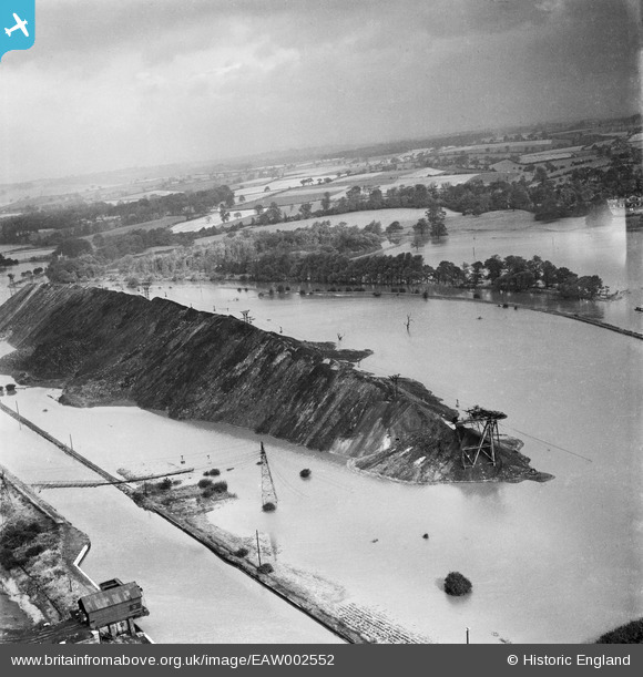
EAW002552 ENGLAND (1946). A spoil tip surrounded by flood waters between the Aire & Calder Navigation and the River Aire, Woodlesford, from the south, 1946
© Hawlfraint cyfranwyr OpenStreetMap a thrwyddedwyd gan yr OpenStreetMap Foundation. 2025. Trwyddedir y gartograffeg fel CC BY-SA.
Manylion
| Pennawd | [EAW002552] A spoil tip surrounded by flood waters between the Aire & Calder Navigation and the River Aire, Woodlesford, from the south, 1946 |
| Cyfeirnod | EAW002552 |
| Dyddiad | 21-September-1946 |
| Dolen | |
| Enw lle | WOODLESFORD |
| Plwyf | |
| Ardal | |
| Gwlad | ENGLAND |
| Dwyreiniad / Gogleddiad | 437732, 428693 |
| Hydred / Lledred | -1.4276982242919, 53.753015035962 |
| Cyfeirnod Grid Cenedlaethol | SE377287 |
Pinnau
 Class31 |
Friday 6th of September 2013 06:30:06 AM |


![[EAW002552] A spoil tip surrounded by flood waters between the Aire & Calder Navigation and the River Aire, Woodlesford, from the south, 1946](http://britainfromabove.org.uk/sites/all/libraries/aerofilms-images/public/100x100/EAW/002/EAW002552.jpg)
![[EAW002553] A spoil tip surrounded by flood waters between the Aire & Calder Navigation and the River Aire, Woodlesford, from the south-west, 1946](http://britainfromabove.org.uk/sites/all/libraries/aerofilms-images/public/100x100/EAW/002/EAW002553.jpg)
![[EAW002532] A spoil tip surrounded by flood waters between the Aire & Calder Navigation and the River Aire, Woodlesford, from the south-east, 1946](http://britainfromabove.org.uk/sites/all/libraries/aerofilms-images/public/100x100/EAW/002/EAW002532.jpg)