
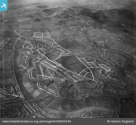
EAW003448 ENGLAND (1946). Housing estate under construction to the north of Deerlands Avenue, Parson Cross, 1946
© Hawlfraint cyfranwyr OpenStreetMap a thrwyddedwyd gan yr OpenStreetMap Foundation. 2025. Trwyddedir y gartograffeg fel CC BY-SA.
Delweddau cyfagos (3)
EAW003448

EAW003446

EAW003441

Manylion
| Pennawd | [EAW003448] Housing estate under construction to the north of Deerlands Avenue, Parson Cross, 1946 |
| Cyfeirnod | EAW003448 |
| Dyddiad | 4-December-1946 |
| Dolen | |
| Enw lle | PARSON CROSS |
| Plwyf | |
| Ardal | |
| Gwlad | ENGLAND |
| Dwyreiniad / Gogleddiad | 435129, 393322 |
| Hydred / Lledred | -1.4711626959433, 53.435249449966 |
| Cyfeirnod Grid Cenedlaethol | SK351933 |
Pinnau
 redmist |
Tuesday 20th of October 2020 10:53:05 AM | |
redmist |
Thursday 17th of January 2019 11:37:49 PM | |
redmist |
Thursday 17th of January 2019 11:34:22 PM | |
redmist |
Thursday 17th of January 2019 11:31:46 PM | |
CrossMan |
Wednesday 15th of February 2017 06:25:13 PM |