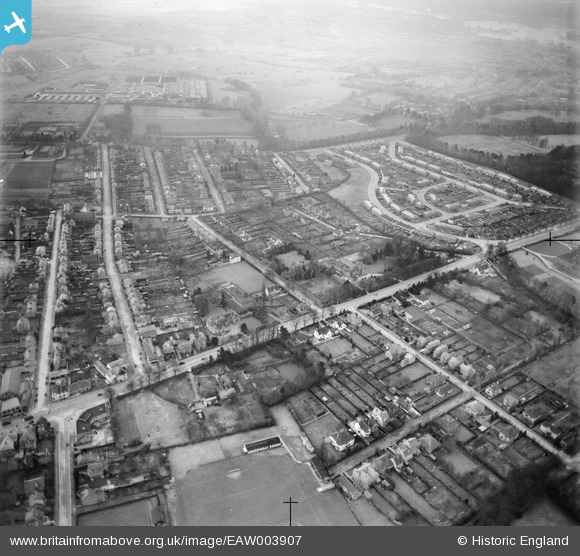
EAW003907 ENGLAND (1947). Residential area around London Road and Latimer Road, New Headington, 1947
© Hawlfraint cyfranwyr OpenStreetMap a thrwyddedwyd gan yr OpenStreetMap Foundation. 2025. Trwyddedir y gartograffeg fel CC BY-SA.
Manylion
| Pennawd | [EAW003907] Residential area around London Road and Latimer Road, New Headington, 1947 |
| Cyfeirnod | EAW003907 |
| Dyddiad | 20-March-1947 |
| Dolen | |
| Enw lle | NEW HEADINGTON |
| Plwyf | |
| Ardal | |
| Gwlad | ENGLAND |
| Dwyreiniad / Gogleddiad | 454184, 206830 |
| Hydred / Lledred | -1.2148882680656, 51.757080360118 |
| Cyfeirnod Grid Cenedlaethol | SP542068 |
Pinnau
 Mervyn |
Tuesday 4th of October 2016 04:55:20 PM | |
 Sarah Jessop |
Wednesday 27th of January 2016 11:44:31 AM | |
 Stephanie (Oxford) |
Tuesday 26th of January 2016 07:50:29 AM | |
 Stephanie (Oxford) |
Tuesday 26th of January 2016 07:48:34 AM | |
 davefulham |
Monday 2nd of February 2015 05:17:17 PM | |
 PG2012 |
Wednesday 16th of October 2013 08:56:59 PM | |
 PG2012 |
Wednesday 16th of October 2013 08:56:58 PM | |
 PG2012 |
Wednesday 16th of October 2013 08:56:15 PM | |
 PG2012 |
Wednesday 16th of October 2013 08:55:10 PM |
Cyfraniadau Grŵp
 Mattle |
Monday 30th of June 2014 04:09:03 PM |


![[EAW003907] Residential area around London Road and Latimer Road, New Headington, 1947](http://britainfromabove.org.uk/sites/all/libraries/aerofilms-images/public/100x100/EAW/003/EAW003907.jpg)
![[EPW022538] New Headington and new housing at Valentia Road, Headington, from the west, 1928](http://britainfromabove.org.uk/sites/all/libraries/aerofilms-images/public/100x100/EPW/022/EPW022538.jpg)
