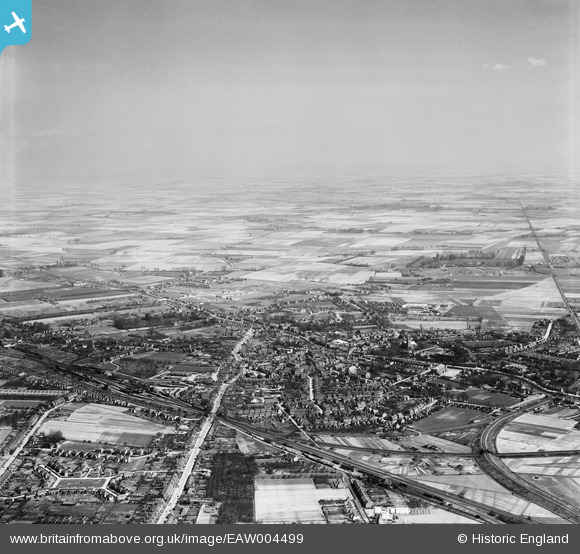
EAW004499 ENGLAND (1947). The town and surrounding fenland, Spalding, from the south-west, 1947
© Hawlfraint cyfranwyr OpenStreetMap a thrwyddedwyd gan yr OpenStreetMap Foundation. 2024. Trwyddedir y gartograffeg fel CC BY-SA.
Delweddau cyfagos (7)
Manylion
| Pennawd | [EAW004499] The town and surrounding fenland, Spalding, from the south-west, 1947 |
| Cyfeirnod | EAW004499 |
| Dyddiad | 16-April-1947 |
| Dolen | |
| Enw lle | SPALDING |
| Plwyf | |
| Ardal | |
| Gwlad | ENGLAND |
| Dwyreiniad / Gogleddiad | 524410, 322457 |
| Hydred / Lledred | -0.1550756865448, 52.784997631731 |
| Cyfeirnod Grid Cenedlaethol | TF244225 |
Pinnau
 Custom House Lad |
Thursday 19th of May 2016 10:18:24 PM | |
 Mikelwarb |
Wednesday 2nd of April 2014 09:31:28 AM | |
 Mikelwarb |
Wednesday 2nd of April 2014 09:26:12 AM | |
 Mikelwarb |
Wednesday 2nd of April 2014 09:25:11 AM | |
 bescotbeast |
Thursday 27th of February 2014 07:26:48 PM | |
 bescotbeast |
Thursday 27th of February 2014 07:26:13 PM | |
 bescotbeast |
Thursday 27th of February 2014 07:25:21 PM | |
 bescotbeast |
Thursday 27th of February 2014 07:24:45 PM | |
 bescotbeast |
Thursday 27th of February 2014 07:22:08 PM | |
 bescotbeast |
Thursday 27th of February 2014 07:21:23 PM | |
 bescotbeast |
Thursday 27th of February 2014 07:18:04 PM |


![[EAW004499] The town and surrounding fenland, Spalding, from the south-west, 1947](http://britainfromabove.org.uk/sites/all/libraries/aerofilms-images/public/100x100/EAW/004/EAW004499.jpg)
![[EAW004498] The town and surrounding fenland, Spalding, from the west, 1947](http://britainfromabove.org.uk/sites/all/libraries/aerofilms-images/public/100x100/EAW/004/EAW004498.jpg)
![[EPW031854] The town, Spalding, 1930](http://britainfromabove.org.uk/sites/all/libraries/aerofilms-images/public/100x100/EPW/031/EPW031854.jpg)
![[EPW031855] The town centre, Spalding, 1930](http://britainfromabove.org.uk/sites/all/libraries/aerofilms-images/public/100x100/EPW/031/EPW031855.jpg)
![[EPW031882] The town centre, Spalding, 1930](http://britainfromabove.org.uk/sites/all/libraries/aerofilms-images/public/100x100/EPW/031/EPW031882.jpg)
![[EPW031856] The cattle market and town centre, Spalding, 1930](http://britainfromabove.org.uk/sites/all/libraries/aerofilms-images/public/100x100/EPW/031/EPW031856.jpg)
![[EPW031870] The cattle market and town centre, Spalding, 1930](http://britainfromabove.org.uk/sites/all/libraries/aerofilms-images/public/100x100/EPW/031/EPW031870.jpg)