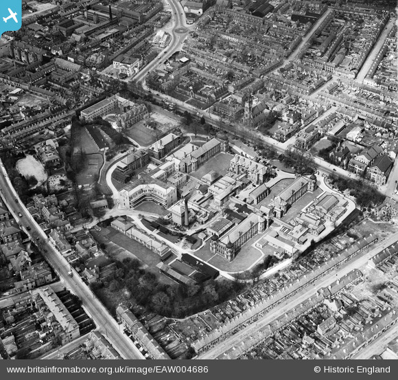
EAW004686 ENGLAND (1947). The Royal Infirmary (London Road Community Hospital), Derby, 1947
© Hawlfraint cyfranwyr OpenStreetMap a thrwyddedwyd gan yr OpenStreetMap Foundation. 2025. Trwyddedir y gartograffeg fel CC BY-SA.
Delweddau cyfagos (5)
Manylion
| Pennawd | [EAW004686] The Royal Infirmary (London Road Community Hospital), Derby, 1947 |
| Cyfeirnod | EAW004686 |
| Dyddiad | 22-April-1947 |
| Dolen | |
| Enw lle | DERBY |
| Plwyf | |
| Ardal | |
| Gwlad | ENGLAND |
| Dwyreiniad / Gogleddiad | 435702, 335503 |
| Hydred / Lledred | -1.4689942246124, 52.915443521663 |
| Cyfeirnod Grid Cenedlaethol | SK357355 |


![[EAW004686] The Royal Infirmary (London Road Community Hospital), Derby, 1947](http://britainfromabove.org.uk/sites/all/libraries/aerofilms-images/public/100x100/EAW/004/EAW004686.jpg)
![[EAW004685] The Royal Infirmary (London Road Community Hospital), Derby, 1947](http://britainfromabove.org.uk/sites/all/libraries/aerofilms-images/public/100x100/EAW/004/EAW004685.jpg)
![[EPW041814] The city centre, Derby, from the south-east, 1933](http://britainfromabove.org.uk/sites/all/libraries/aerofilms-images/public/100x100/EPW/041/EPW041814.jpg)
![[EAW004657] The city centre, Derby, from the south-east, 1947](http://britainfromabove.org.uk/sites/all/libraries/aerofilms-images/public/100x100/EAW/004/EAW004657.jpg)
![[EAW004652] The city centre, Derby, from the south, 1947](http://britainfromabove.org.uk/sites/all/libraries/aerofilms-images/public/100x100/EAW/004/EAW004652.jpg)

