
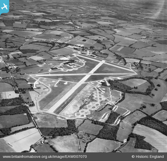
EAW007070 ENGLAND (1947). Membury Airfield alongside Membury Camp, Lambourn, 1947
© Hawlfraint cyfranwyr OpenStreetMap a thrwyddedwyd gan yr OpenStreetMap Foundation. 2025. Trwyddedir y gartograffeg fel CC BY-SA.
Delweddau cyfagos (5)
EAW007070

EAW007069

EAW007065

EAW007066

EAW007068

Manylion
| Pennawd | [EAW007070] Membury Airfield alongside Membury Camp, Lambourn, 1947 |
| Cyfeirnod | EAW007070 |
| Dyddiad | 11-June-1947 |
| Dolen | |
| Enw lle | LAMBOURN |
| Plwyf | LAMBOURN |
| Ardal | |
| Gwlad | ENGLAND |
| Dwyreiniad / Gogleddiad | 430781, 175504 |
| Hydred / Lledred | -1.5567290174865, 51.477170961042 |
| Cyfeirnod Grid Cenedlaethol | SU308755 |
Pinnau
 Matt Aldred edob.mattaldred.com |
Wednesday 19th of May 2021 02:34:36 PM | |
 MB |
Tuesday 12th of November 2013 10:26:51 AM | |
MB |
Tuesday 12th of November 2013 10:24:07 AM | |
MB |
Tuesday 12th of November 2013 10:13:04 AM | |
MB |
Tuesday 12th of November 2013 10:12:23 AM | |
MB |
Tuesday 12th of November 2013 10:09:39 AM |
Cyfraniadau Grŵp
A history of the airfield is given on the Lambourn web site: www.lambourn.info/main.asp?pid=218&child=0&parent=221,218,304,305,308,217,387,258,157,388,273,170,236,172,310,313,318,307,&lang= It was used for D Day operations and for the Market Garden event. By April 1947, two months before this shot, it was out of use |
MB |
Tuesday 12th of November 2013 10:19:19 AM |