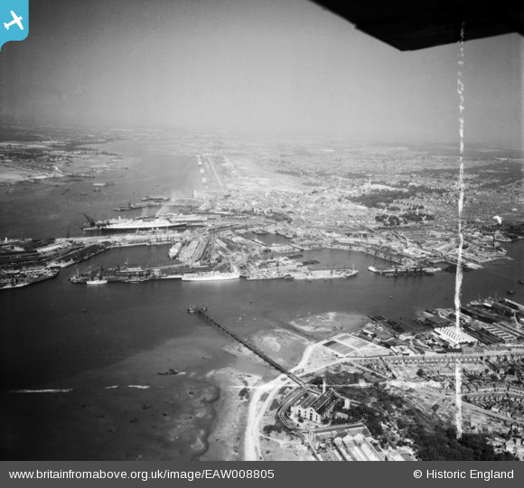
EAW008805 ENGLAND (1947). The docks and the city, Southampton, from the south-east, 1947. This image was marked by Aerofilms Ltd for photo editing.
© Hawlfraint cyfranwyr OpenStreetMap a thrwyddedwyd gan yr OpenStreetMap Foundation. 2025. Trwyddedir y gartograffeg fel CC BY-SA.
Manylion
| Pennawd | [EAW008805] The docks and the city, Southampton, from the south-east, 1947. This image was marked by Aerofilms Ltd for photo editing. |
| Cyfeirnod | EAW008805 |
| Dyddiad | 9-August-1947 |
| Dolen | |
| Enw lle | SOUTHAMPTON |
| Plwyf | |
| Ardal | |
| Gwlad | ENGLAND |
| Dwyreiniad / Gogleddiad | 443316, 110275 |
| Hydred / Lledred | -1.3840921164158, 50.889780088666 |
| Cyfeirnod Grid Cenedlaethol | SU433103 |


![[EAW008805] The docks and the city, Southampton, from the south-east, 1947. This image was marked by Aerofilms Ltd for photo editing.](http://britainfromabove.org.uk/sites/all/libraries/aerofilms-images/public/100x100/EAW/008/EAW008805.jpg)
![[EAW033410] The Docks, Southampton, from the east, 1950](http://britainfromabove.org.uk/sites/all/libraries/aerofilms-images/public/100x100/EAW/033/EAW033410.jpg)
![[EPW009084] Woolston and the River Itchen, Southampton, from the south, 1923. This image has been produced from a copy-negative.](http://britainfromabove.org.uk/sites/all/libraries/aerofilms-images/public/100x100/EPW/009/EPW009084.jpg)
