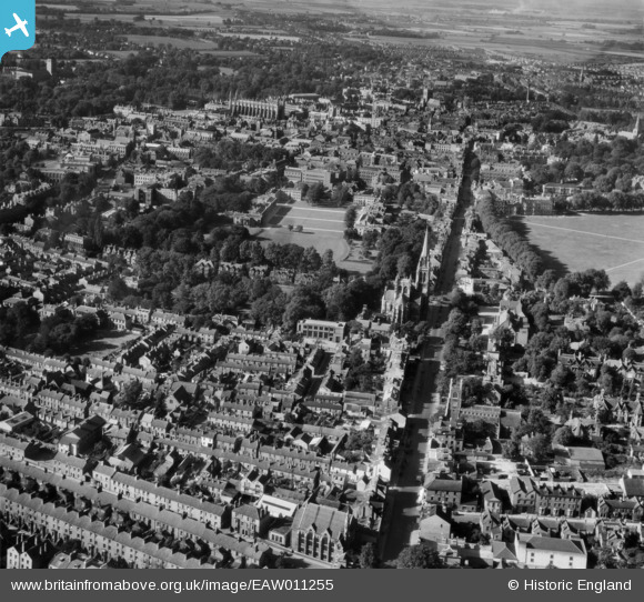
EAW011255 ENGLAND (1947). Regent Street, St Andrew's Street and the city, Cambridge, 1947
© Hawlfraint cyfranwyr OpenStreetMap a thrwyddedwyd gan yr OpenStreetMap Foundation. 2025. Trwyddedir y gartograffeg fel CC BY-SA.
Delweddau cyfagos (5)
EAW011255

EAW002921

EPW059039

EPW025485

EAW011254

Manylion
| Pennawd | [EAW011255] Regent Street, St Andrew's Street and the city, Cambridge, 1947 |
| Cyfeirnod | EAW011255 |
| Dyddiad | 30-September-1947 |
| Dolen | |
| Enw lle | CAMBRIDGE |
| Plwyf | |
| Ardal | |
| Gwlad | ENGLAND |
| Dwyreiniad / Gogleddiad | 545418, 257745 |
| Hydred / Lledred | 0.12797642348894, 52.198328645262 |
| Cyfeirnod Grid Cenedlaethol | TL454577 |
Pinnau
 Class31 |
Wednesday 23rd of July 2014 03:23:09 PM | |
Class31 |
Wednesday 23rd of July 2014 03:21:38 PM | |
Class31 |
Wednesday 23rd of July 2014 03:20:19 PM | |
Class31 |
Wednesday 23rd of July 2014 03:17:28 PM | |
Class31 |
Wednesday 23rd of July 2014 03:16:00 PM | |
 john |
Sunday 8th of June 2014 04:43:06 PM | |
john |
Sunday 8th of June 2014 04:42:06 PM | |
john |
Sunday 8th of June 2014 04:39:51 PM | |
john |
Sunday 8th of June 2014 04:36:27 PM | |
john |
Sunday 8th of June 2014 04:33:52 PM | |
john |
Sunday 8th of June 2014 04:31:53 PM | |
innpictime |
Wednesday 6th of November 2013 12:04:33 PM |