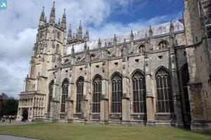
EAW014336 ENGLAND (1948). Christ Church Cathedral and the city, Canterbury, from the south, 1948
© Hawlfraint cyfranwyr OpenStreetMap a thrwyddedwyd gan yr OpenStreetMap Foundation. 2025. Trwyddedir y gartograffeg fel CC BY-SA.
Delweddau cyfagos (6)
Manylion
| Pennawd | [EAW014336] Christ Church Cathedral and the city, Canterbury, from the south, 1948 |
| Cyfeirnod | EAW014336 |
| Dyddiad | 13-April-1948 |
| Dolen | |
| Enw lle | CANTERBURY |
| Plwyf | |
| Ardal | |
| Gwlad | ENGLAND |
| Dwyreiniad / Gogleddiad | 615014, 157458 |
| Hydred / Lledred | 1.0830881192121, 51.275123225086 |
| Cyfeirnod Grid Cenedlaethol | TR150575 |
Pinnau
 Mike |
Tuesday 25th of July 2023 02:37:52 AM | |
 Mike |
Tuesday 25th of July 2023 02:32:37 AM | |
 Mike |
Tuesday 25th of July 2023 02:20:18 AM | |
 Alan McFaden |
Thursday 10th of July 2014 02:15:07 PM | |
 Alan McFaden |
Thursday 10th of July 2014 02:14:31 PM |


![[EAW014336] Christ Church Cathedral and the city, Canterbury, from the south, 1948](http://britainfromabove.org.uk/sites/all/libraries/aerofilms-images/public/100x100/EAW/014/EAW014336.jpg)
![[EAW004802] The city, Canterbury, from the south, 1947](http://britainfromabove.org.uk/sites/all/libraries/aerofilms-images/public/100x100/EAW/004/EAW004802.jpg)
![[EAW011396] Christ Church Cathedral and the city centre, Canterbury, from the south, 1947](http://britainfromabove.org.uk/sites/all/libraries/aerofilms-images/public/100x100/EAW/011/EAW011396.jpg)
![[EPW018612] Christ Church Cathedral and the city, Canterbury, 1927](http://britainfromabove.org.uk/sites/all/libraries/aerofilms-images/public/100x100/EPW/018/EPW018612.jpg)
![[EPW013269] Canterbury East Railway Station and environs, Canterbury, 1925. This image has been produced from a print.](http://britainfromabove.org.uk/sites/all/libraries/aerofilms-images/public/100x100/EPW/013/EPW013269.jpg)
![[EAW004805] The city centre, Canterbury, from the south-west, 1947](http://britainfromabove.org.uk/sites/all/libraries/aerofilms-images/public/100x100/EAW/004/EAW004805.jpg)

