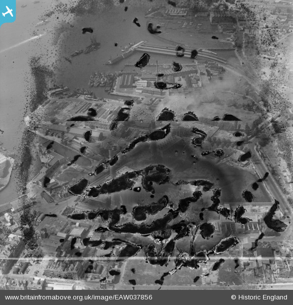
EAW037856 ENGLAND (1951). Portsmouth Power Station (site of) off Gunwharf Road, Old Portsmouth, 1951. This image has been produced from a damaged negative.
© Hawlfraint cyfranwyr OpenStreetMap a thrwyddedwyd gan yr OpenStreetMap Foundation. 2025. Trwyddedir y gartograffeg fel CC BY-SA.
Delweddau cyfagos (35)
Manylion
| Pennawd | [EAW037856] Portsmouth Power Station (site of) off Gunwharf Road, Old Portsmouth, 1951. This image has been produced from a damaged negative. |
| Cyfeirnod | EAW037856 |
| Dyddiad | 19-July-1951 |
| Dolen | |
| Enw lle | OLD PORTSMOUTH |
| Plwyf | |
| Ardal | |
| Gwlad | ENGLAND |
| Dwyreiniad / Gogleddiad | 463201, 99728 |
| Hydred / Lledred | -1.1031996130689, 50.793103121965 |
| Cyfeirnod Grid Cenedlaethol | SZ632997 |
Pinnau
 flubber |
Monday 23rd of November 2015 02:11:34 PM | |
 flubber |
Monday 23rd of November 2015 02:10:31 PM | |
 flubber |
Monday 23rd of November 2015 02:08:15 PM | |
 Class31 |
Thursday 16th of October 2014 11:19:06 PM | |
 Class31 |
Thursday 16th of October 2014 10:53:34 PM | |
 Class31 |
Thursday 16th of October 2014 10:35:03 PM |
Cyfraniadau Grŵp
Portsmouth Harbour Station from the Spinnaker Tower, 16/10/2014 |
 Class31 |
Saturday 17th of January 2015 08:51:05 PM |


![[EAW037856] Portsmouth Power Station (site of) off Gunwharf Road, Old Portsmouth, 1951. This image has been produced from a damaged negative.](http://britainfromabove.org.uk/sites/all/libraries/aerofilms-images/public/100x100/EAW/037/EAW037856.jpg)
![[EAW032157] The Power Station and environs, Portsmouth, 1950. This image was marked by Aerofilms Ltd for photo editing.](http://britainfromabove.org.uk/sites/all/libraries/aerofilms-images/public/100x100/EAW/032/EAW032157.jpg)
![[EAW037857] Portsmouth Power Station off Gunwharf Road, Old Portsmouth, 1951. This image has been produced from a damaged negative.](http://britainfromabove.org.uk/sites/all/libraries/aerofilms-images/public/100x100/EAW/037/EAW037857.jpg)
![[EAW034582] Portsmouth Power Station, Camber Dock and environs, Portsmouth, 1951. This image was marked by Aerofilms Ltd for photo editing.](http://britainfromabove.org.uk/sites/all/libraries/aerofilms-images/public/100x100/EAW/034/EAW034582.jpg)
![[EAW037858] Portsmouth Power Station off Gunwharf Road, Old Portsmouth, 1951. This image has been produced from a damaged negative.](http://britainfromabove.org.uk/sites/all/libraries/aerofilms-images/public/100x100/EAW/037/EAW037858.jpg)
![[EAW037861] Portsmouth Power Station (site of) off Gunwharf Road, Old Portsmouth, 1951. This image has been produced from a damaged negative.](http://britainfromabove.org.uk/sites/all/libraries/aerofilms-images/public/100x100/EAW/037/EAW037861.jpg)
![[EAW032149] The Power Station on Gunwharf Road, Camber Dock and environs, Portsmouth, 1950. This image was marked by Aerofilms Ltd for photo editing.](http://britainfromabove.org.uk/sites/all/libraries/aerofilms-images/public/100x100/EAW/032/EAW032149.jpg)
![[EAW034583] Portsmouth Power Station, Camber Dock and environs, Portsmouth, 1951. This image was marked by Aerofilms Ltd for photo editing.](http://britainfromabove.org.uk/sites/all/libraries/aerofilms-images/public/100x100/EAW/034/EAW034583.jpg)
![[EAW034581] Portsmouth Power Station off Gunwharf Road and environs, Portsmouth, 1951. This image was marked by Aerofilms Ltd for photo editing.](http://britainfromabove.org.uk/sites/all/libraries/aerofilms-images/public/100x100/EAW/034/EAW034581.jpg)
![[EAW037859] Portsmouth Power Station off Gunwharf Road, Old Portsmouth, 1951](http://britainfromabove.org.uk/sites/all/libraries/aerofilms-images/public/100x100/EAW/037/EAW037859.jpg)
![[EAW037863] Portsmouth Power Station off Gunwharf Road, Old Portsmouth, 1951. This image has been produced from a print marked by Aerofilms Ltd for photo editing.](http://britainfromabove.org.uk/sites/all/libraries/aerofilms-images/public/100x100/EAW/037/EAW037863.jpg)
![[EAW032154] Camber Dock and the Power Station on Gunwharf Road, Portsmouth, 1950. This image was marked by Aerofilms Ltd for photo editing.](http://britainfromabove.org.uk/sites/all/libraries/aerofilms-images/public/100x100/EAW/032/EAW032154.jpg)
![[EAW037860] Portsmouth Power Station off Gunwharf Road, Old Portsmouth, 1951. This image has been produced from a print marked by Aerofilms Ltd for photo editing.](http://britainfromabove.org.uk/sites/all/libraries/aerofilms-images/public/100x100/EAW/037/EAW037860.jpg)
![[EAW037862] Portsmouth Power Station off Gunwharf Road and environs, Old Portsmouth, 1951. This image has been produced from a print marked by Aerofilms Ltd for photo editing.](http://britainfromabove.org.uk/sites/all/libraries/aerofilms-images/public/100x100/EAW/037/EAW037862.jpg)
![[EAW032156] The Power Station on Gunwharf Road, Portsmouth, 1950. This image was marked by Aerofilms Ltd for photo editing.](http://britainfromabove.org.uk/sites/all/libraries/aerofilms-images/public/100x100/EAW/032/EAW032156.jpg)
![[EAW032151] The Power Station on Gunwharf Road and environs, Portsmouth, 1950. This image was marked by Aerofilms Ltd for photo editing.](http://britainfromabove.org.uk/sites/all/libraries/aerofilms-images/public/100x100/EAW/032/EAW032151.jpg)
![[EAW032153] The Power Station on Gunwharf Road and environs, Portsmouth, 1950. This image was marked by Aerofilms Ltd for photo editing.](http://britainfromabove.org.uk/sites/all/libraries/aerofilms-images/public/100x100/EAW/032/EAW032153.jpg)
![[EAW034584] Portsmouth Power Station, Camber Dock and environs, Portsmouth, 1951. This image was marked by Aerofilms Ltd for photo editing.](http://britainfromabove.org.uk/sites/all/libraries/aerofilms-images/public/100x100/EAW/034/EAW034584.jpg)
![[EAW034585] Portsmouth Power Station off Gunwharf Road and environs, Portsmouth, 1951. This image was marked by Aerofilms Ltd for photo editing.](http://britainfromabove.org.uk/sites/all/libraries/aerofilms-images/public/100x100/EAW/034/EAW034585.jpg)
![[EAW032147] The Power Station on Gunwharf Road and environs, Portsmouth, 1950. This image was marked by Aerofilms Ltd for photo editing.](http://britainfromabove.org.uk/sites/all/libraries/aerofilms-images/public/100x100/EAW/032/EAW032147.jpg)
![[EAW032150] The Power Station, Warblington Street and environs, Portsmouth, 1950. This image was marked by Aerofilms Ltd for photo editing.](http://britainfromabove.org.uk/sites/all/libraries/aerofilms-images/public/100x100/EAW/032/EAW032150.jpg)
![[EAW034587] Portsmouth Power Station and Camber Dock, Portsmouth, 1951. This image was marked by Aerofilms Ltd for photo editing.](http://britainfromabove.org.uk/sites/all/libraries/aerofilms-images/public/100x100/EAW/034/EAW034587.jpg)
![[EAW032152] The Power Station and environs, Portsmouth, 1950. This image was marked by Aerofilms Ltd for photo editing.](http://britainfromabove.org.uk/sites/all/libraries/aerofilms-images/public/100x100/EAW/032/EAW032152.jpg)
![[EAW037853] Portsmouth Power Station off Gunwharf Road, Old Portsmouth, 1951. This image has been produced from a damaged negative.](http://britainfromabove.org.uk/sites/all/libraries/aerofilms-images/public/100x100/EAW/037/EAW037853.jpg)
![[EAW032155] St George's Road, the Power Station and environs, Portsmouth, 1950. This image was marked by Aerofilms Ltd for photo editing.](http://britainfromabove.org.uk/sites/all/libraries/aerofilms-images/public/100x100/EAW/032/EAW032155.jpg)
![[EAW034586] Portsmouth Power Station off Gunwharf Road and environs, Portsmouth, 1951. This image was marked by Aerofilms Ltd for photo editing.](http://britainfromabove.org.uk/sites/all/libraries/aerofilms-images/public/100x100/EAW/034/EAW034586.jpg)
![[EAW034592] Portsmouth Power Station off Gunwharf Road, Portsmouth, 1951. This image was marked by Aerofilms Ltd for photo editing.](http://britainfromabove.org.uk/sites/all/libraries/aerofilms-images/public/100x100/EAW/034/EAW034592.jpg)
![[EAW032148] Warblington Street, the Power Station and Inner Camber, Portsmouth, 1950](http://britainfromabove.org.uk/sites/all/libraries/aerofilms-images/public/100x100/EAW/032/EAW032148.jpg)
![[EAW034591] Portsmouth Power Station and Warblington Street, Portsmouth, 1951. This image was marked by Aerofilms Ltd for photo editing.](http://britainfromabove.org.uk/sites/all/libraries/aerofilms-images/public/100x100/EAW/034/EAW034591.jpg)
![[EAW037854] Portsmouth Power Station off Gunwharf Road, Old Portsmouth, 1951. This image has been produced from a damaged negative.](http://britainfromabove.org.uk/sites/all/libraries/aerofilms-images/public/100x100/EAW/037/EAW037854.jpg)
![[EAW034590] Portsmouth Power Station off Gunwharf Road, Portsmouth, 1951. This image was marked by Aerofilms Ltd for photo editing.](http://britainfromabove.org.uk/sites/all/libraries/aerofilms-images/public/100x100/EAW/034/EAW034590.jpg)
![[EAW034588] Portsmouth Power Station off Gunwharf Road, Portsmouth, 1951. This image was marked by Aerofilms Ltd for photo editing.](http://britainfromabove.org.uk/sites/all/libraries/aerofilms-images/public/100x100/EAW/034/EAW034588.jpg)
![[EAW034589] Portsmouth Power Station off Gunwharf Road, Portsmouth, 1951. This image was marked by Aerofilms Ltd for photo editing.](http://britainfromabove.org.uk/sites/all/libraries/aerofilms-images/public/100x100/EAW/034/EAW034589.jpg)
![[EAW037852] Portsmouth Power Station (site of) off Gunwharf Road, Old Portsmouth, 1951. This image has been produced from a damaged negative.](http://britainfromabove.org.uk/sites/all/libraries/aerofilms-images/public/100x100/EAW/037/EAW037852.jpg)
![[EAW037855] Portsmouth Power Station (site of) off Gunwharf Road, Old Portsmouth, 1951. This image has been produced from a damaged negative.](http://britainfromabove.org.uk/sites/all/libraries/aerofilms-images/public/100x100/EAW/037/EAW037855.jpg)