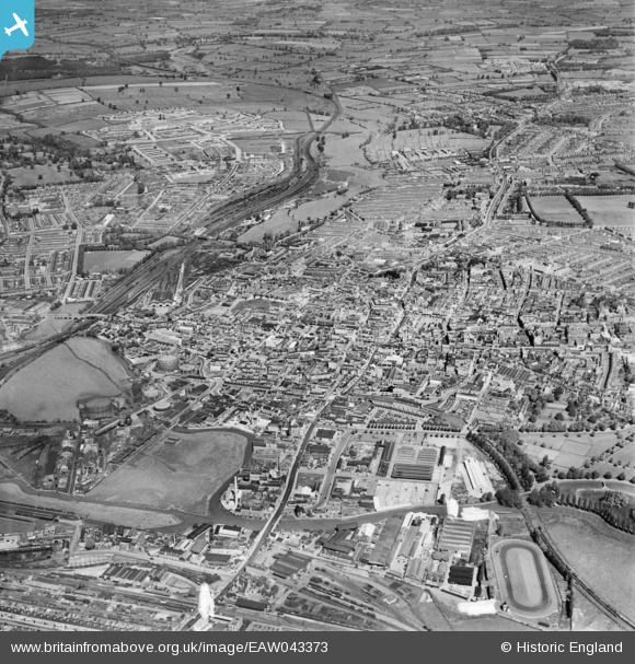
EAW043373 ENGLAND (1952). The town, Northampton, 1952
© Hawlfraint cyfranwyr OpenStreetMap a thrwyddedwyd gan yr OpenStreetMap Foundation. 2025. Trwyddedir y gartograffeg fel CC BY-SA.
Delweddau cyfagos (10)
Manylion
| Pennawd | [EAW043373] The town, Northampton, 1952 |
| Cyfeirnod | EAW043373 |
| Dyddiad | 13-May-1952 |
| Dolen | |
| Enw lle | NORTHAMPTON |
| Plwyf | |
| Ardal | |
| Gwlad | ENGLAND |
| Dwyreiniad / Gogleddiad | 475213, 260541 |
| Hydred / Lledred | -0.8984462179979, 52.237517921662 |
| Cyfeirnod Grid Cenedlaethol | SP752605 |
Pinnau
 SalB |
Tuesday 11th of May 2021 10:05:52 PM | |
 SalB |
Tuesday 11th of May 2021 09:52:48 PM | |
 John W |
Sunday 7th of August 2016 11:44:43 PM | |
 John W |
Sunday 7th of August 2016 11:43:41 PM | |
 John W |
Sunday 7th of August 2016 11:42:36 PM |


![[EAW043373] The town, Northampton, 1952](http://britainfromabove.org.uk/sites/all/libraries/aerofilms-images/public/100x100/EAW/043/EAW043373.jpg)
![[EAW043375] The town, Northampton, 1952](http://britainfromabove.org.uk/sites/all/libraries/aerofilms-images/public/100x100/EAW/043/EAW043375.jpg)
![[EPW057746] Mare Fair, Gold Street and the town centre, Northampton, 1938. This image has been affected by flare.](http://britainfromabove.org.uk/sites/all/libraries/aerofilms-images/public/100x100/EPW/057/EPW057746.jpg)
![[EAW008860] The town centre, Northampton, from the south-west, 1947](http://britainfromabove.org.uk/sites/all/libraries/aerofilms-images/public/100x100/EAW/008/EAW008860.jpg)
![[EAW008858] The town centre, Northampton, 1947](http://britainfromabove.org.uk/sites/all/libraries/aerofilms-images/public/100x100/EAW/008/EAW008858.jpg)
![[EAW043372] The town, Northampton, 1952](http://britainfromabove.org.uk/sites/all/libraries/aerofilms-images/public/100x100/EAW/043/EAW043372.jpg)
![[EPW057749] All Saints' Church, Market Square and the town centre, Northampton, 1938. This image has been produced from a damaged negative.](http://britainfromabove.org.uk/sites/all/libraries/aerofilms-images/public/100x100/EPW/057/EPW057749.jpg)
![[EPW057748] All Saints' Church, Market Square and the town centre, Northampton, 1938. This image has been produced from a damaged negative.](http://britainfromabove.org.uk/sites/all/libraries/aerofilms-images/public/100x100/EPW/057/EPW057748.jpg)
![[EPW034342] The town centre, Northampton, from the south-west, 1930](http://britainfromabove.org.uk/sites/all/libraries/aerofilms-images/public/100x100/EPW/034/EPW034342.jpg)
![[EPW057745] Market Square, All Saints' Church and the town centre, Northampton, 1938. This image has been produced from a damaged negative.](http://britainfromabove.org.uk/sites/all/libraries/aerofilms-images/public/100x100/EPW/057/EPW057745.jpg)