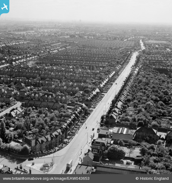
EAW043653 ENGLAND (1952). Green Lane, Goodmayes, from the north-east, 1952
© Hawlfraint cyfranwyr OpenStreetMap a thrwyddedwyd gan yr OpenStreetMap Foundation. 2025. Trwyddedir y gartograffeg fel CC BY-SA.
Manylion
| Pennawd | [EAW043653] Green Lane, Goodmayes, from the north-east, 1952 |
| Cyfeirnod | EAW043653 |
| Dyddiad | 4-June-1952 |
| Dolen | |
| Enw lle | GOODMAYES |
| Plwyf | |
| Ardal | |
| Gwlad | ENGLAND |
| Dwyreiniad / Gogleddiad | 546218, 186975 |
| Hydred / Lledred | 0.10968371360262, 51.562196436624 |
| Cyfeirnod Grid Cenedlaethol | TQ462870 |
Pinnau
 jonnyace |
Friday 29th of December 2023 11:43:17 PM | |
 Madheia Salim |
Tuesday 16th of August 2022 01:04:23 PM | |
 rac |
Saturday 2nd of August 2014 10:49:23 AM | |
 rac |
Saturday 2nd of August 2014 10:42:39 AM |


![[EAW043653] Green Lane, Goodmayes, from the north-east, 1952](http://britainfromabove.org.uk/sites/all/libraries/aerofilms-images/public/100x100/EAW/043/EAW043653.jpg)
![[EAW043654] Breamore Road, Ilford, from the north-east, 1952](http://britainfromabove.org.uk/sites/all/libraries/aerofilms-images/public/100x100/EAW/043/EAW043654.jpg)