
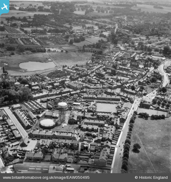
EAW050495 ENGLAND (1953). Manchester Road, the bowling green and environs, Knutsford, 1953
© Hawlfraint cyfranwyr OpenStreetMap a thrwyddedwyd gan yr OpenStreetMap Foundation. 2025. Trwyddedir y gartograffeg fel CC BY-SA.
Delweddau cyfagos (6)
EAW050495

EPW019445

EPW019446

EAW050497

EPW019447

EPW019443

Manylion
| Pennawd | [EAW050495] Manchester Road, the bowling green and environs, Knutsford, 1953 |
| Cyfeirnod | EAW050495 |
| Dyddiad | 8-July-1953 |
| Dolen | |
| Enw lle | KNUTSFORD |
| Plwyf | KNUTSFORD |
| Ardal | |
| Gwlad | ENGLAND |
| Dwyreiniad / Gogleddiad | 375117, 378790 |
| Hydred / Lledred | -2.373452508608, 53.305197782711 |
| Cyfeirnod Grid Cenedlaethol | SJ751788 |
Pinnau
 stardelta |
Saturday 12th of April 2025 11:34:32 PM | |
stardelta |
Saturday 12th of April 2025 11:16:40 PM | |
Ian Warburton |
Sunday 28th of December 2014 11:00:24 PM | |
Ian Warburton |
Thursday 18th of December 2014 07:53:40 PM | |
stardelta |
Monday 1st of September 2014 08:26:29 PM |