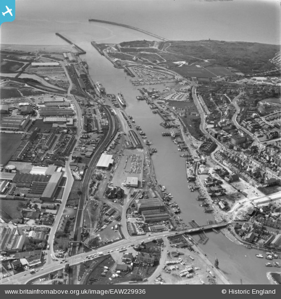
EAW229936 ENGLAND (1972). Newhaven Harbour and the River Ouse, Newhaven, 1972
© Hawlfraint cyfranwyr OpenStreetMap a thrwyddedwyd gan yr OpenStreetMap Foundation. 2025. Trwyddedir y gartograffeg fel CC BY-SA.
Manylion
| Pennawd | [EAW229936] Newhaven Harbour and the River Ouse, Newhaven, 1972 |
| Cyfeirnod | EAW229936 |
| Dyddiad | 28-April-1972 |
| Dolen | |
| Enw lle | NEWHAVEN |
| Plwyf | NEWHAVEN |
| Ardal | |
| Gwlad | ENGLAND |
| Dwyreiniad / Gogleddiad | 544870, 101113 |
| Hydred / Lledred | 0.055629763064899, 50.790892769331 |
| Cyfeirnod Grid Cenedlaethol | TQ449011 |
Pinnau
 lokash |
Saturday 28th of September 2024 09:15:08 AM | |
 lokash |
Saturday 28th of September 2024 09:11:59 AM | |
 lokash |
Saturday 28th of September 2024 09:11:33 AM | |
 Kevin |
Monday 12th of June 2017 08:21:33 AM | |
 Kevin |
Monday 12th of June 2017 08:16:09 AM | |
 Brightonboy |
Friday 14th of October 2016 08:30:37 AM | |
 Brightonboy |
Friday 14th of October 2016 08:25:57 AM | |
 Brightonboy |
Friday 14th of October 2016 08:22:06 AM | |
 Brightonboy |
Friday 14th of October 2016 08:20:01 AM | |
 Brightonboy |
Friday 14th of October 2016 08:19:08 AM | |
 bescotbeast |
Friday 14th of October 2016 02:11:30 AM | |
 Billy Turner |
Thursday 15th of September 2016 06:46:13 PM | |
 ken |
Monday 23rd of November 2015 03:40:45 PM | |
 ken |
Monday 23rd of November 2015 12:03:59 PM |


![[EAW229936] Newhaven Harbour and the River Ouse, Newhaven, 1972](http://britainfromabove.org.uk/sites/all/libraries/aerofilms-images/public/100x100/EAW/229/EAW229936.jpg)
![[EAW028826] Coal Wharf and Railway Wharf, Newhaven, 1950](http://britainfromabove.org.uk/sites/all/libraries/aerofilms-images/public/100x100/EAW/028/EAW028826.jpg)
![[EAW028827] Bay View Road, the swing bridge looking towards Railway Approach and The Drove, Newhaven, from the south-west, 1950](http://britainfromabove.org.uk/sites/all/libraries/aerofilms-images/public/100x100/EAW/028/EAW028827.jpg)
![[EPW011508] London & Paris Hotel on Railway Quay and environs, Newhaven, 1924. This image has been produced from a copy-negative.](http://britainfromabove.org.uk/sites/all/libraries/aerofilms-images/public/100x100/EPW/011/EPW011508.jpg)
