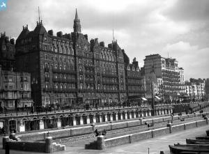
EPW000219 ENGLAND (1920). Madeira Drive area and Brighton Town, Brighton, from the south-east, 1920
© Hawlfraint cyfranwyr OpenStreetMap a thrwyddedwyd gan yr OpenStreetMap Foundation. 2025. Trwyddedir y gartograffeg fel CC BY-SA.
Delweddau cyfagos (9)
Manylion
| Pennawd | [EPW000219] Madeira Drive area and Brighton Town, Brighton, from the south-east, 1920 |
| Cyfeirnod | EPW000219 |
| Dyddiad | February-1920 |
| Dolen | |
| Enw lle | BRIGHTON |
| Plwyf | |
| Ardal | |
| Gwlad | ENGLAND |
| Dwyreiniad / Gogleddiad | 531609, 103198 |
| Hydred / Lledred | -0.13167729677491, 50.812797691551 |
| Cyfeirnod Grid Cenedlaethol | TQ316032 |
Pinnau
 Alan McFaden |
Sunday 22nd of June 2014 03:48:26 PM | |
 Alan McFaden |
Monday 22nd of July 2013 06:28:53 PM | |
 Alan McFaden |
Monday 22nd of July 2013 06:28:16 PM | |
 Alan McFaden |
Monday 22nd of July 2013 06:27:43 PM | |
 Alan McFaden |
Monday 22nd of July 2013 06:27:03 PM | |
 Alan McFaden |
Monday 22nd of July 2013 06:26:29 PM | |
 Alan McFaden |
Monday 22nd of July 2013 06:25:49 PM | |
 Alan McFaden |
Monday 22nd of July 2013 06:25:12 PM | |
 S Hope |
Thursday 28th of June 2012 05:41:00 PM | |
 takingletiss |
Tuesday 26th of June 2012 07:49:38 PM |
Cyfraniadau Grŵp
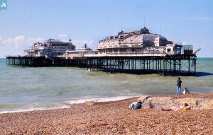
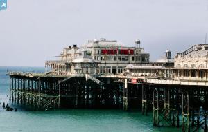
I have to agree with fellow contributors in that the title of this image is wrong. This is not Madeira Drive. This is the West Pier and not the Palace Pier. |
 Class31 |
Tuesday 3rd of June 2014 11:53:58 AM |
 classicforever |
Sunday 15th of July 2012 01:39:48 PM | |
Caption is wrong, this is the Kings Road not Madeira drive. The pier is the west pier, the large building is the metropole hotel. I Haven't checked the coordinates, but probably off too. |
 oceanhippie |
Tuesday 26th of June 2012 07:52:14 PM |
Definitely King's Road. That's the West Pier on the left and the Metropole Hotel on the right. The map pin is in the wrong place on the OS map for this photo |
 takingletiss |
Tuesday 26th of June 2012 07:52:14 PM |


![[EPW000219] Madeira Drive area and Brighton Town, Brighton, from the south-east, 1920](http://britainfromabove.org.uk/sites/all/libraries/aerofilms-images/public/100x100/EPW/000/EPW000219.jpg)
![[EAW037806] Palace Pier and the city, Brighton, from the south-east, 1951. This image has been produced from a print marked by Aerofilms Ltd for photo editing.](http://britainfromabove.org.uk/sites/all/libraries/aerofilms-images/public/100x100/EAW/037/EAW037806.jpg)
![[EAW043164] The Palace Pier, Brighton, from the south-east, 1952](http://britainfromabove.org.uk/sites/all/libraries/aerofilms-images/public/100x100/EAW/043/EAW043164.jpg)
![[EAW011023] Palace Pier, West Pier and the town, Brighton, from the south-east, 1947](http://britainfromabove.org.uk/sites/all/libraries/aerofilms-images/public/100x100/EAW/011/EAW011023.jpg)
![[EAW037805] Palace Pier and environs, Brighton, from the south, 1951. This image has been produced from a print marked by Aerofilms Ltd for photo editing.](http://britainfromabove.org.uk/sites/all/libraries/aerofilms-images/public/100x100/EAW/037/EAW037805.jpg)
![[EAW006602] The Palace Pier, seafront and town, Brighton, from the south-east, 1947](http://britainfromabove.org.uk/sites/all/libraries/aerofilms-images/public/100x100/EAW/006/EAW006602.jpg)
![[EAW022257] Palace Pier, Brighton, from the south-east, 1949](http://britainfromabove.org.uk/sites/all/libraries/aerofilms-images/public/100x100/EAW/022/EAW022257.jpg)
![[EAW022679] Palace Pier and the town, Brighton, from the south-east, 1949](http://britainfromabove.org.uk/sites/all/libraries/aerofilms-images/public/100x100/EAW/022/EAW022679.jpg)
![[EAW022248] Palace Pier and the town, Brighton, from the south-east, 1949](http://britainfromabove.org.uk/sites/all/libraries/aerofilms-images/public/100x100/EAW/022/EAW022248.jpg)
