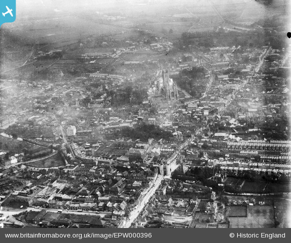
EPW000396 ENGLAND (1920). Canterbury, Kent, from the west, 1920
© Hawlfraint cyfranwyr OpenStreetMap a thrwyddedwyd gan yr OpenStreetMap Foundation. 2025. Trwyddedir y gartograffeg fel CC BY-SA.
Delweddau cyfagos (5)
Manylion
| Pennawd | [EPW000396] Canterbury, Kent, from the west, 1920 |
| Cyfeirnod | EPW000396 |
| Dyddiad | April-1920 |
| Dolen | |
| Enw lle | CANTERBURY |
| Plwyf | |
| Ardal | |
| Gwlad | ENGLAND |
| Dwyreiniad / Gogleddiad | 614638, 158111 |
| Hydred / Lledred | 1.0780972344982, 51.281128832027 |
| Cyfeirnod Grid Cenedlaethol | TR146581 |
Pinnau
 Stewart Lawrie |
Sunday 25th of June 2023 05:27:39 PM | |
 Marian |
Sunday 8th of May 2016 03:10:49 PM | |
 hnritchie |
Thursday 28th of August 2014 10:52:51 AM | |
 hnritchie |
Thursday 28th of August 2014 10:49:39 AM | |
 Alan McFaden |
Thursday 10th of July 2014 01:00:22 PM | |
 EZTD |
Friday 29th of June 2012 09:51:33 PM | |
 EZTD |
Friday 29th of June 2012 09:50:57 PM | |
 EZTD |
Friday 29th of June 2012 09:50:06 PM | |
 EZTD |
Friday 29th of June 2012 09:49:35 PM |


![[EPW000396] Canterbury, Kent, from the west, 1920](http://britainfromabove.org.uk/sites/all/libraries/aerofilms-images/public/100x100/EPW/000/EPW000396.jpg)
![[EPW013267] West Gate and the city centre, Canterbury, 1925. This image has been produced from a copy-negative.](http://britainfromabove.org.uk/sites/all/libraries/aerofilms-images/public/100x100/EPW/013/EPW013267.jpg)
![[EPW009148] St Peter's Street and Westgate, Canterbury, 1923. This image has been produced from a print.](http://britainfromabove.org.uk/sites/all/libraries/aerofilms-images/public/100x100/EPW/009/EPW009148.jpg)
![[EAW004803] The city centre, Canterbury, from the north-east, 1947](http://britainfromabove.org.uk/sites/all/libraries/aerofilms-images/public/100x100/EAW/004/EAW004803.jpg)
![[EAW004804] The city centre, Canterbury, from the west, 1947](http://britainfromabove.org.uk/sites/all/libraries/aerofilms-images/public/100x100/EAW/004/EAW004804.jpg)

