
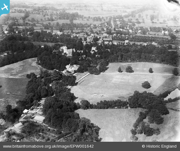
EPW001642 ENGLAND (1920). Stanmore Park and St John's Church, Stanmore, 1920
© Hawlfraint cyfranwyr OpenStreetMap a thrwyddedwyd gan yr OpenStreetMap Foundation. 2025. Trwyddedir y gartograffeg fel CC BY-SA.
Delweddau cyfagos (3)
EPW001642

EPW001643

EPW001641

Manylion
| Pennawd | [EPW001642] Stanmore Park and St John's Church, Stanmore, 1920 |
| Cyfeirnod | EPW001642 |
| Dyddiad | June-1920 |
| Dolen | |
| Enw lle | STANMORE |
| Plwyf | |
| Ardal | |
| Gwlad | ENGLAND |
| Dwyreiniad / Gogleddiad | 516626, 191967 |
| Hydred / Lledred | -0.31539711963084, 51.61396457037 |
| Cyfeirnod Grid Cenedlaethol | TQ166920 |
Pinnau
 up above |
Saturday 30th of June 2012 11:38:34 AM |