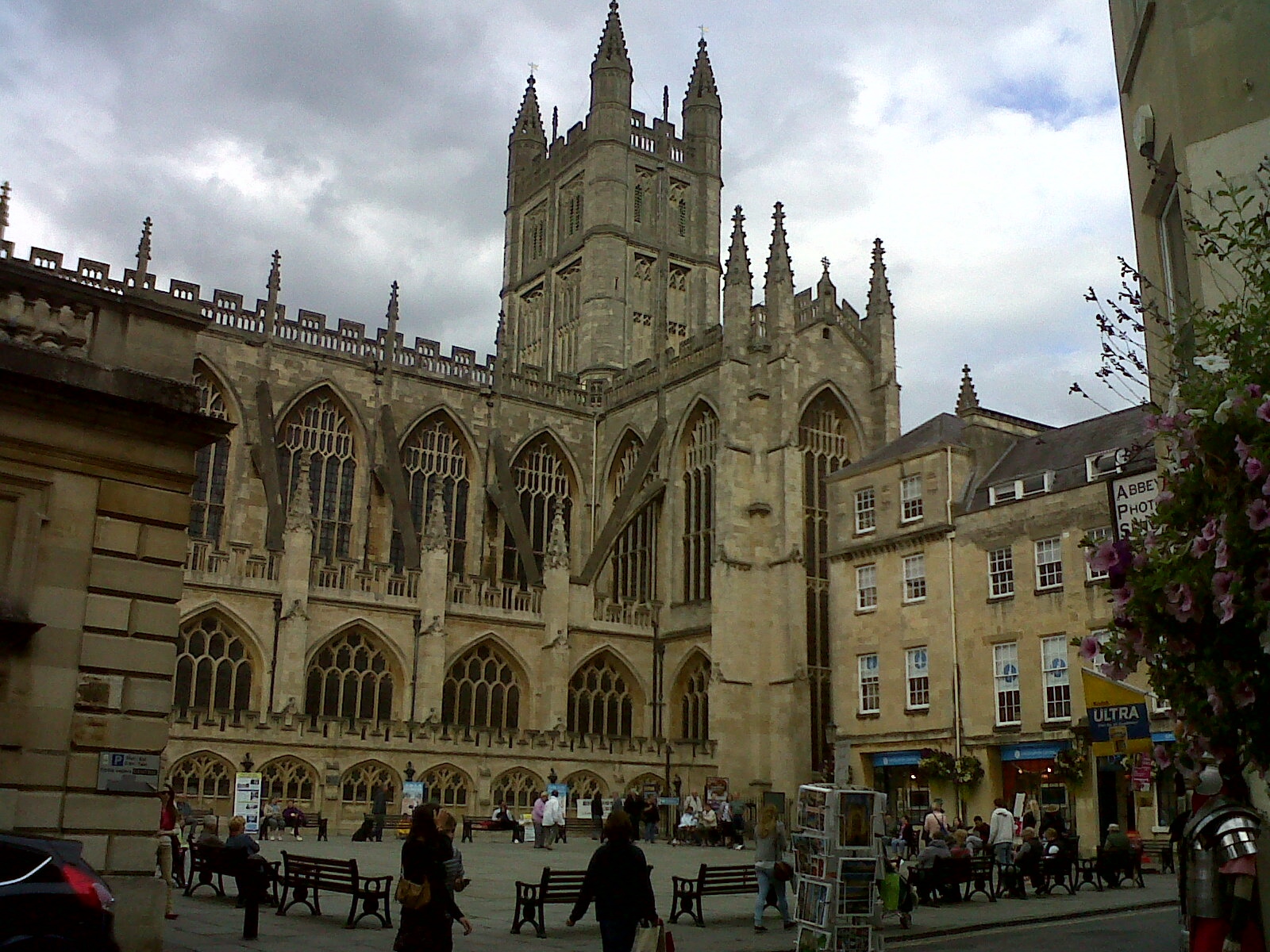
EPW001942 ENGLAND (1920). The Abbey Church of St Peter and St Paul and town centre, Bath, 1920
© Hawlfraint cyfranwyr OpenStreetMap a thrwyddedwyd gan yr OpenStreetMap Foundation. 2025. Trwyddedir y gartograffeg fel CC BY-SA.
Delweddau cyfagos (28)
Manylion
| Pennawd | [EPW001942] The Abbey Church of St Peter and St Paul and town centre, Bath, 1920 |
| Cyfeirnod | EPW001942 |
| Dyddiad | July-1920 |
| Dolen | |
| Enw lle | BATH |
| Plwyf | |
| Ardal | |
| Gwlad | ENGLAND |
| Dwyreiniad / Gogleddiad | 375128, 164700 |
| Hydred / Lledred | -2.3574198397632, 51.38030738316 |
| Cyfeirnod Grid Cenedlaethol | ST751647 |
Pinnau
 Class31 |
Wednesday 16th of July 2014 07:53:50 PM | |
 Class31 |
Monday 19th of November 2012 04:42:50 PM | |
 Class31 |
Monday 19th of November 2012 04:42:18 PM | |
 Class31 |
Monday 19th of November 2012 04:41:56 PM | |
 Chelsea61 |
Sunday 29th of July 2012 10:30:23 AM | |
 Chelsea61 |
Sunday 29th of July 2012 10:29:54 AM | |
 kent |
Thursday 19th of July 2012 11:20:58 PM | |
 kent |
Thursday 19th of July 2012 11:19:48 PM | |
 kent |
Thursday 19th of July 2012 11:18:51 PM | |
 kent |
Thursday 19th of July 2012 11:17:53 PM | |
 Class31 |
Tuesday 10th of July 2012 10:37:18 AM | |
 Class31 |
Tuesday 10th of July 2012 10:36:39 AM | |
 Class31 |
Tuesday 10th of July 2012 10:35:36 AM | |
 Rex Phare |
Wednesday 27th of June 2012 09:03:11 AM | |
 Rex Phare |
Wednesday 27th of June 2012 08:54:42 AM |


![[EPW001942] The Abbey Church of St Peter and St Paul and town centre, Bath, 1920](http://britainfromabove.org.uk/sites/all/libraries/aerofilms-images/public/100x100/EPW/001/EPW001942.jpg)
![[EAW000748] The Church of St James, Abbey Church of St Peter and St Paul and the surrounding city, Bath, 1946](http://britainfromabove.org.uk/sites/all/libraries/aerofilms-images/public/100x100/EAW/000/EAW000748.jpg)
![[EAW000746] The Abbey Church of St Peter and St Paul and environs, Bath, 1946](http://britainfromabove.org.uk/sites/all/libraries/aerofilms-images/public/100x100/EAW/000/EAW000746.jpg)
![[EPW001945] The Abbey Church of St Peter and St Paul, Bath, 1920](http://britainfromabove.org.uk/sites/all/libraries/aerofilms-images/public/100x100/EPW/001/EPW001945.jpg)
![[EPW033153] The Abbey Church of St Peter and St Paul and the city, Bath, 1930](http://britainfromabove.org.uk/sites/all/libraries/aerofilms-images/public/100x100/EPW/033/EPW033153.jpg)
![[EAW000754] The city, Bath, from the east, 1946](http://britainfromabove.org.uk/sites/all/libraries/aerofilms-images/public/100x100/EAW/000/EAW000754.jpg)
![[EAW000759] The Abbey Church of St Peter and St Paul and the surrounding city, Bath, from the north-east, 1946](http://britainfromabove.org.uk/sites/all/libraries/aerofilms-images/public/100x100/EAW/000/EAW000759.jpg)
![[EAW000760] The Abbey Church of St Peter and St Paul and the surrounding city, Bath, 1946](http://britainfromabove.org.uk/sites/all/libraries/aerofilms-images/public/100x100/EAW/000/EAW000760.jpg)
![[EPW001161] View over Bath city centre and the Abbey, Bath, 1920](http://britainfromabove.org.uk/sites/all/libraries/aerofilms-images/public/100x100/EPW/001/EPW001161.jpg)
![[EAW000756] The Church of St John the Evangelist, Abbey Church of St Peter and St Paul and surrounding city, Bath, 1946](http://britainfromabove.org.uk/sites/all/libraries/aerofilms-images/public/100x100/EAW/000/EAW000756.jpg)
![[EPW001953] General view of the town centre, Bath, 1920](http://britainfromabove.org.uk/sites/all/libraries/aerofilms-images/public/100x100/EPW/001/EPW001953.jpg)
![[EAW000757] The Abbey Church of St Peter and St Paul looking towards St James's Bridge, Bath, 1946](http://britainfromabove.org.uk/sites/all/libraries/aerofilms-images/public/100x100/EAW/000/EAW000757.jpg)
![[EAW023882] The Abbey Church of St Peter and St Paul and the city centre, Bath, from the south-east, 1949. This image has been produced from a print.](http://britainfromabove.org.uk/sites/all/libraries/aerofilms-images/public/100x100/EAW/023/EAW023882.jpg)
![[EAW023884] North Parade Bridge and the city centre, Bath, 1949. This image has been produced from a print.](http://britainfromabove.org.uk/sites/all/libraries/aerofilms-images/public/100x100/EAW/023/EAW023884.jpg)
![[EAW000755] The Church of St John the Evangelist, Abbey Church of St Peter and St Paul and surrounding city, Bath, 1946](http://britainfromabove.org.uk/sites/all/libraries/aerofilms-images/public/100x100/EAW/000/EAW000755.jpg)
![[EPW053141] The Abbey Church of St Peter and St Paul, the Roman Baths and the city centre, Bath, 1937](http://britainfromabove.org.uk/sites/all/libraries/aerofilms-images/public/100x100/EPW/053/EPW053141.jpg)
![[EAW000747] The area around the Church of St James and New Orchard Street, Bath, 1946](http://britainfromabove.org.uk/sites/all/libraries/aerofilms-images/public/100x100/EAW/000/EAW000747.jpg)
![[EPW001957] General view of the town centre, Bath, from the east, 1920](http://britainfromabove.org.uk/sites/all/libraries/aerofilms-images/public/100x100/EPW/001/EPW001957.jpg)
![[EAW000761] The city, Bath, 1946](http://britainfromabove.org.uk/sites/all/libraries/aerofilms-images/public/100x100/EAW/000/EAW000761.jpg)
![[EPW001950] The Weir and Parade Gardens, Bath, 1920](http://britainfromabove.org.uk/sites/all/libraries/aerofilms-images/public/100x100/EPW/001/EPW001950.jpg)
![[EAW000749] The area between York Street and Southgate (Churchill) Bridge, Bath, 1946](http://britainfromabove.org.uk/sites/all/libraries/aerofilms-images/public/100x100/EAW/000/EAW000749.jpg)
![[EAW023885] Parade Gardens and the city centre, Bath, 1949. This image has been produced from a print.](http://britainfromabove.org.uk/sites/all/libraries/aerofilms-images/public/100x100/EAW/023/EAW023885.jpg)
![[EPW001169] View over central Bath from Alexandra Park, Bath, 1920](http://britainfromabove.org.uk/sites/all/libraries/aerofilms-images/public/100x100/EPW/001/EPW001169.jpg)
![[EPR000130] Broad Quay and the city centre, Bath, 1934](http://britainfromabove.org.uk/sites/all/libraries/aerofilms-images/public/100x100/EPR/000/EPR000130.jpg)
![[EAW000758] North Parade looking towards the railway station, Bath, 1946](http://britainfromabove.org.uk/sites/all/libraries/aerofilms-images/public/100x100/EAW/000/EAW000758.jpg)
![[EPW048402] Bath and County Recreation Ground, the Cricket Ground and environs, Bath, 1935](http://britainfromabove.org.uk/sites/all/libraries/aerofilms-images/public/100x100/EPW/048/EPW048402.jpg)
![[EAW049901] Bath, the second day of the Somerset-Kent county cricket match, 1953](http://britainfromabove.org.uk/sites/all/libraries/aerofilms-images/public/100x100/EAW/049/EAW049901.jpg)
![[EPW048393] Gay Street and environs, Bath, from the south-east, 1935](http://britainfromabove.org.uk/sites/all/libraries/aerofilms-images/public/100x100/EPW/048/EPW048393.jpg)

