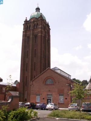
EPW005369 ENGLAND (1921). Longbridge Motor Works, Longbridge, from the south-east, 1921
© Hawlfraint cyfranwyr OpenStreetMap a thrwyddedwyd gan yr OpenStreetMap Foundation. 2025. Trwyddedir y gartograffeg fel CC BY-SA.
Manylion
| Pennawd | [EPW005369] Longbridge Motor Works, Longbridge, from the south-east, 1921 |
| Cyfeirnod | EPW005369 |
| Dyddiad | March-1921 |
| Dolen | |
| Enw lle | LONGBRIDGE |
| Plwyf | |
| Ardal | |
| Gwlad | ENGLAND |
| Dwyreiniad / Gogleddiad | 401195, 276992 |
| Hydred / Lledred | -1.9824380770567, 52.390571369241 |
| Cyfeirnod Grid Cenedlaethol | SP012770 |
Pinnau
 Paul |
Friday 4th of December 2020 02:04:44 PM | |
 PURCELL |
Friday 24th of January 2014 10:19:44 AM | |
 PURCELL |
Sunday 17th of November 2013 10:15:16 AM | |
 PURCELL |
Sunday 17th of November 2013 10:14:11 AM | |
 ypres |
Wednesday 27th of June 2012 10:20:07 AM | |
 ypres |
Wednesday 27th of June 2012 10:17:35 AM | |
It did colapse but unfortunately some workers who were digging it out at the time to facilitate the addition of extra tracks lost their lives. |
 Paul |
Thursday 5th of July 2012 01:02:07 AM |
http://www.railwaysarchive.co.uk/docsummary.php?docID=1910 here you will find the goverment report on the incident. |
 Paul |
Thursday 5th of July 2012 01:09:40 AM |
 ypres |
Wednesday 27th of June 2012 09:43:16 AM | |
 ypres |
Wednesday 27th of June 2012 09:38:18 AM | |
 ypres |
Wednesday 27th of June 2012 09:37:10 AM | |
I think it was Longbridge pumping station ? |
 Deswill |
Monday 2nd of July 2012 09:54:11 PM |
Yes It was a Water pumping station. A really beautiful work of architecture. |
 Paul |
Thursday 5th of July 2012 01:06:05 AM |
It was a pumping station. There were a pair of water workers cottages in front on the Bristol road. We lived nearby and never had power cuts during the 70s blackouts due to the importance of the water supply. Sadly all were demolished mid 70's. |
 balln |
Monday 18th of November 2013 09:50:14 PM |
It was a pumping station. There were a pair of water workers cottages in front on the Bristol road. We lived nearby and never had power cuts during the 70s blackouts due to the importance of the water supply. Sadly all were demolished mid 70's. |
 balln |
Monday 18th of November 2013 09:50:17 PM |
 ypres |
Wednesday 27th of June 2012 09:29:38 AM | |
 ypres |
Wednesday 27th of June 2012 08:55:42 AM | |
This Is actually Now on the widened railway cutting. But Thurlestone Road is nearby very close. Notice how the Slope for dearmont is very gradual nothing like the one in six or so we have today. They moved an awful lot of earth here . |
 Paul |
Thursday 5th of July 2012 01:26:22 AM |
 Barry Barcrest |
Tuesday 26th of June 2012 11:25:03 AM | |
My great-grandfather assisted in the construction of the tower; he was a bricklayer's hod-carrier, and got involved in a fist-fight at the top when it was almost complete! |
 emu-star |
Thursday 20th of November 2014 07:43:42 PM |


![[EPW005369] Longbridge Motor Works, Longbridge, from the south-east, 1921](http://britainfromabove.org.uk/sites/all/libraries/aerofilms-images/public/100x100/EPW/005/EPW005369.jpg)
![[EPW026897] Longbridge Motor Works and Northfield Airfield, Longbridge, 1929](http://britainfromabove.org.uk/sites/all/libraries/aerofilms-images/public/100x100/EPW/026/EPW026897.jpg)
![[EPW010506] The Longbridge Motor Works, Longbridge, 1924](http://britainfromabove.org.uk/sites/all/libraries/aerofilms-images/public/100x100/EPW/010/EPW010506.jpg)
