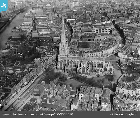
EPW005476 ENGLAND (1921). St Mary Redcliffe, Bristol, 1921
© Hawlfraint cyfranwyr OpenStreetMap a thrwyddedwyd gan yr OpenStreetMap Foundation. 2025. Trwyddedir y gartograffeg fel CC BY-SA.
Delweddau cyfagos (6)
Manylion
| Pennawd | [EPW005476] St Mary Redcliffe, Bristol, 1921 |
| Cyfeirnod | EPW005476 |
| Dyddiad | 20-March-1921 |
| Dolen | |
| Enw lle | BRISTOL |
| Plwyf | |
| Ardal | |
| Gwlad | ENGLAND |
| Dwyreiniad / Gogleddiad | 359107, 172337 |
| Hydred / Lledred | -2.5885181938122, 51.448052229068 |
| Cyfeirnod Grid Cenedlaethol | ST591723 |
Pinnau
 MB |
Tuesday 30th of August 2016 10:32:04 PM | |
 allenb1 |
Saturday 6th of June 2015 10:38:28 PM | |
 brambly |
Thursday 22nd of May 2014 07:50:11 PM | |
 brambly |
Tuesday 11th of December 2012 09:25:01 PM | |
 brambly |
Tuesday 11th of December 2012 09:24:21 PM | |
 brambly |
Tuesday 11th of December 2012 09:23:09 PM | |
 kent |
Friday 27th of July 2012 12:12:22 AM | |
 kent |
Friday 27th of July 2012 12:09:55 AM | |
 kent |
Friday 27th of July 2012 12:08:56 AM | |
This seems to be THE shot tower. Watts, who lived here refined and patented (1782) the process of making shot using surface tension in falling droplets. Apparently the works carried on underground into early sandstone workings. This was sometimes (at least) disturbed by the ingress of the tides. The property was apparently destroyed for a traffic scheme in 1968. |
 Chris Willis |
Sunday 9th of February 2014 05:02:47 PM |
 kent |
Friday 27th of July 2012 12:08:24 AM | |
 kent |
Friday 27th of July 2012 12:07:52 AM |


![[EPW005476] St Mary Redcliffe, Bristol, 1921](http://britainfromabove.org.uk/sites/all/libraries/aerofilms-images/public/100x100/EPW/005/EPW005476.jpg)
![[EAW000739] The Church of St Mary Redcliff and environs, Bristol, 1946](http://britainfromabove.org.uk/sites/all/libraries/aerofilms-images/public/100x100/EAW/000/EAW000739.jpg)
![[EAW000738] Redcliffe Bridge, the Church of St Mary Redcliff and the city, Bristol, from the south-east, 1946](http://britainfromabove.org.uk/sites/all/libraries/aerofilms-images/public/100x100/EAW/000/EAW000738.jpg)
![[EAW000737] Redcliff Hill and the Church of St Mary Redcliff, Bristol, 1946](http://britainfromabove.org.uk/sites/all/libraries/aerofilms-images/public/100x100/EAW/000/EAW000737.jpg)
![[EPW008824] Redcliffe Wharf, Bristol, 1923](http://britainfromabove.org.uk/sites/all/libraries/aerofilms-images/public/100x100/EPW/008/EPW008824.jpg)
![[EPW008820] Redcliffe Wharf and Queen Square, Bristol, 1923](http://britainfromabove.org.uk/sites/all/libraries/aerofilms-images/public/100x100/EPW/008/EPW008820.jpg)