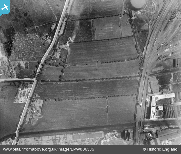
EPW006336 ENGLAND (1921). Fields to the north of Sculcoates Cemetery, Sculcoates, 1921
© Hawlfraint cyfranwyr OpenStreetMap a thrwyddedwyd gan yr OpenStreetMap Foundation. 2025. Trwyddedir y gartograffeg fel CC BY-SA.
Delweddau cyfagos (6)
Manylion
| Pennawd | [EPW006336] Fields to the north of Sculcoates Cemetery, Sculcoates, 1921 |
| Cyfeirnod | EPW006336 |
| Dyddiad | May-1921 |
| Dolen | |
| Enw lle | SCULCOATES |
| Plwyf | |
| Ardal | |
| Gwlad | ENGLAND |
| Dwyreiniad / Gogleddiad | 509383, 431237 |
| Hydred / Lledred | -0.34036460149841, 53.765761525359 |
| Cyfeirnod Grid Cenedlaethol | TA094312 |
Pinnau
 Mr4b4 |
Sunday 19th of April 2020 03:10:08 PM | |
 Giddo |
Tuesday 31st of May 2016 10:17:52 AM | |
 John Wass |
Sunday 23rd of August 2015 08:26:25 PM | |
 John Wass |
Sunday 23rd of August 2015 08:23:41 PM | |
 John Wass |
Sunday 28th of December 2014 03:13:57 PM | |
 John Wass |
Monday 1st of September 2014 10:48:43 AM | |
 John Wass |
Monday 18th of August 2014 01:33:49 PM |


![[EPW006336] Fields to the north of Sculcoates Cemetery, Sculcoates, 1921](http://britainfromabove.org.uk/sites/all/libraries/aerofilms-images/public/100x100/EPW/006/EPW006336.jpg)
![[EPW042056] The Needlers Ltd Confectionery Works and environs, Sculcoates, from the north-east, 1933](http://britainfromabove.org.uk/sites/all/libraries/aerofilms-images/public/100x100/EPW/042/EPW042056.jpg)
![[EAW015647] The area around Sculcoates Junction and the Gas Works, Sculcoates, 1948](http://britainfromabove.org.uk/sites/all/libraries/aerofilms-images/public/100x100/EAW/015/EAW015647.jpg)
![[EPW006341] Cooling towers and old clay pits beside Sculcoates Junction, Sculcoates, 1921](http://britainfromabove.org.uk/sites/all/libraries/aerofilms-images/public/100x100/EPW/006/EPW006341.jpg)
![[EPW006340] Allotments and open ground to the north of the Hull Corporation Electricity Works, Sculcoates, 1921](http://britainfromabove.org.uk/sites/all/libraries/aerofilms-images/public/100x100/EPW/006/EPW006340.jpg)
![[EPW006339] Sculcoates Junction and the Hull Corporation Electricity Works, Sculcoates, 1921](http://britainfromabove.org.uk/sites/all/libraries/aerofilms-images/public/100x100/EPW/006/EPW006339.jpg)