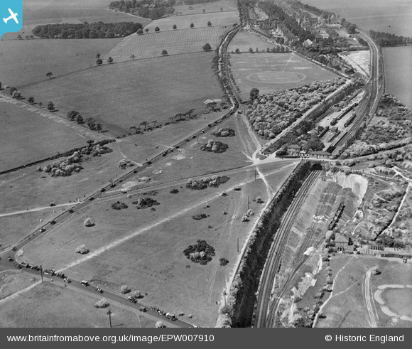
EPW007910 ENGLAND (1922). Banstead Station, Banstead, 1922
© Hawlfraint cyfranwyr OpenStreetMap a thrwyddedwyd gan yr OpenStreetMap Foundation. 2024. Trwyddedir y gartograffeg fel CC BY-SA.
Manylion
| Pennawd | [EPW007910] Banstead Station, Banstead, 1922 |
| Cyfeirnod | EPW007910 |
| Dyddiad | May-1922 |
| Dolen | |
| Enw lle | BANSTEAD |
| Plwyf | |
| Ardal | |
| Gwlad | ENGLAND |
| Dwyreiniad / Gogleddiad | 524642, 160337 |
| Hydred / Lledred | -0.21082785756638, 51.327951762267 |
| Cyfeirnod Grid Cenedlaethol | TQ246603 |
Pinnau
 brianbeckett |
Monday 1st of June 2020 04:12:06 PM | |
 Banstead100 |
Sunday 24th of April 2016 01:28:46 AM | |
 Banstead100 |
Friday 22nd of April 2016 08:56:11 PM | |
 Banstead100 |
Friday 22nd of April 2016 08:55:08 PM | |
 Banstead100 |
Friday 22nd of April 2016 08:53:49 PM | |
 Banstead100 |
Friday 22nd of April 2016 08:53:12 PM | |
 Tina |
Sunday 9th of March 2014 06:25:37 PM | |
 Rob |
Tuesday 5th of November 2013 05:31:20 PM | |
 Rob |
Tuesday 5th of November 2013 05:30:24 PM | |
 christhewino |
Wednesday 24th of July 2013 10:51:10 PM | |
 christhewino |
Wednesday 24th of July 2013 10:50:20 PM | |
 christhewino |
Wednesday 24th of July 2013 10:49:31 PM |


![[EPW007910] Banstead Station, Banstead, 1922](http://britainfromabove.org.uk/sites/all/libraries/aerofilms-images/public/100x100/EPW/007/EPW007910.jpg)
![[EPW008678] Fir Tree Road, Banstead, 1923](http://britainfromabove.org.uk/sites/all/libraries/aerofilms-images/public/100x100/EPW/008/EPW008678.jpg)
![[EPW008679] Fir Tree Road, Banstead, 1923](http://britainfromabove.org.uk/sites/all/libraries/aerofilms-images/public/100x100/EPW/008/EPW008679.jpg)