
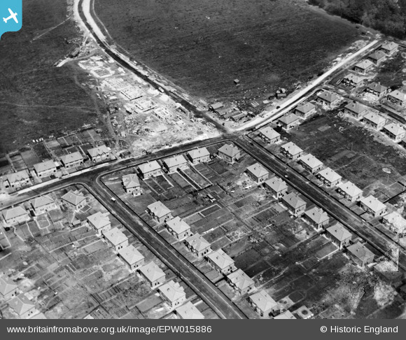
EPW015886 ENGLAND (1926). New housing at Farley Road, Selsdon, 1926
© Hawlfraint cyfranwyr OpenStreetMap a thrwyddedwyd gan yr OpenStreetMap Foundation. 2025. Trwyddedir y gartograffeg fel CC BY-SA.
Delweddau cyfagos (19)
EPW015886

EPW015880

EPW026616

EPW026622

EPW015887

EPW052480

EPW026619

EPW015883

EPW015884

EPW052481

EPW015881

EPW052493

EPW015891

EPW026618

EPW052482

EPW015879

EPW035581

EPW052491

EPW052490

Manylion
| Pennawd | [EPW015886] New housing at Farley Road, Selsdon, 1926 |
| Cyfeirnod | EPW015886 |
| Dyddiad | 25-June-1926 |
| Dolen | |
| Enw lle | SELSDON |
| Plwyf | |
| Ardal | |
| Gwlad | ENGLAND |
| Dwyreiniad / Gogleddiad | 534820, 162434 |
| Hydred / Lledred | -0.064020021883224, 51.344476738413 |
| Cyfeirnod Grid Cenedlaethol | TQ348624 |
