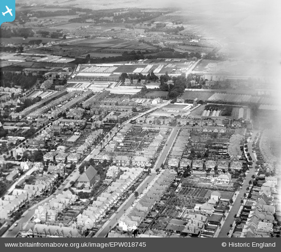
EPW018745 ENGLAND (1927). Windsor Road and environs, Worthing, 1927
© Hawlfraint cyfranwyr OpenStreetMap a thrwyddedwyd gan yr OpenStreetMap Foundation. 2025. Trwyddedir y gartograffeg fel CC BY-SA.
Manylion
| Pennawd | [EPW018745] Windsor Road and environs, Worthing, 1927 |
| Cyfeirnod | EPW018745 |
| Dyddiad | July-1927 |
| Dolen | |
| Enw lle | WORTHING |
| Plwyf | |
| Ardal | |
| Gwlad | ENGLAND |
| Dwyreiniad / Gogleddiad | 515804, 103091 |
| Hydred / Lledred | -0.35597365564668, 50.815212290259 |
| Cyfeirnod Grid Cenedlaethol | TQ158031 |
Pinnau
 SophieWattsit |
Tuesday 9th of February 2021 11:37:32 PM | |
 SophieWattsit |
Tuesday 9th of February 2021 11:36:27 PM |


![[EPW018745] Windsor Road and environs, Worthing, 1927](http://britainfromabove.org.uk/sites/all/libraries/aerofilms-images/public/100x100/EPW/018/EPW018745.jpg)
![[EPW018754] Lyndhurst Road and environs, Worthing, from the east, 1927](http://britainfromabove.org.uk/sites/all/libraries/aerofilms-images/public/100x100/EPW/018/EPW018754.jpg)