
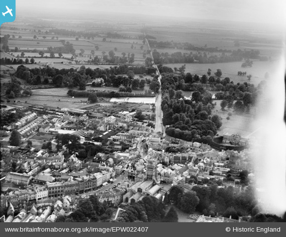
EPW022407 ENGLAND (1928). The Town Centre and the Fosse Way, Cirencester, from the north-east, 1928
© Hawlfraint cyfranwyr OpenStreetMap a thrwyddedwyd gan yr OpenStreetMap Foundation. 2025. Trwyddedir y gartograffeg fel CC BY-SA.
Delweddau cyfagos (21)
EPW022407

EAW031677

EPW022412

EPW006310

EPW022410

EPW022416

EAW031680

EAW015788

EAW031681

EAW015789

EPW022413

EAW006877

EPW022417

EPW061776

EPW061775

EAW006878

EPW061780

EAW015790

EPW022415

EAW031679

EPW022409

Manylion
| Pennawd | [EPW022407] The Town Centre and the Fosse Way, Cirencester, from the north-east, 1928 |
| Cyfeirnod | EPW022407 |
| Dyddiad | August-1928 |
| Dolen | |
| Enw lle | CIRENCESTER |
| Plwyf | CIRENCESTER |
| Ardal | |
| Gwlad | ENGLAND |
| Dwyreiniad / Gogleddiad | 402205, 201992 |
| Hydred / Lledred | -1.9680791891781, 51.716193910632 |
| Cyfeirnod Grid Cenedlaethol | SP022020 |
Pinnau
 MB |
Wednesday 19th of October 2016 04:49:29 PM | |
 Class31 |
Thursday 13th of March 2014 03:21:56 PM | |
Class31 |
Thursday 24th of January 2013 07:49:11 PM | |
Class31 |
Sunday 28th of October 2012 11:29:45 PM | |
Class31 |
Sunday 28th of October 2012 11:28:59 PM | |
Class31 |
Sunday 28th of October 2012 11:28:38 PM | |
MsMoll |
Tuesday 26th of June 2012 03:46:10 PM |