
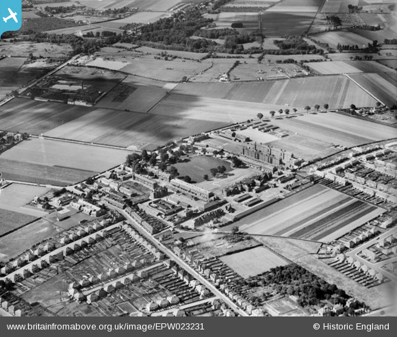
EPW023231 ENGLAND (1928). Hounslow Barracks and Hounslow Heath, Hounslow, 1928
© Hawlfraint cyfranwyr OpenStreetMap a thrwyddedwyd gan yr OpenStreetMap Foundation. 2025. Trwyddedir y gartograffeg fel CC BY-SA.
Delweddau cyfagos (6)
EPW023231

EPR000637

EPW023237

EPW023228

EPW023234

EPW057925

Manylion
| Pennawd | [EPW023231] Hounslow Barracks and Hounslow Heath, Hounslow, 1928 |
| Cyfeirnod | EPW023231 |
| Dyddiad | September-1928 |
| Dolen | |
| Enw lle | HOUNSLOW |
| Plwyf | |
| Ardal | |
| Gwlad | ENGLAND |
| Dwyreiniad / Gogleddiad | 511905, 175565 |
| Hydred / Lledred | -0.38877600764347, 51.467487539224 |
| Cyfeirnod Grid Cenedlaethol | TQ119756 |

