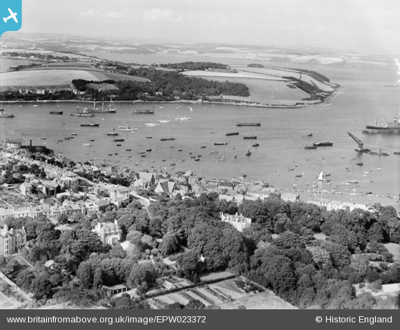
EPW023372 ENGLAND (1928). The Inner Harbour, Falmouth, from the south-west, 1928
© Hawlfraint cyfranwyr OpenStreetMap a thrwyddedwyd gan yr OpenStreetMap Foundation. 2025. Trwyddedir y gartograffeg fel CC BY-SA.
Manylion
| Pennawd | [EPW023372] The Inner Harbour, Falmouth, from the south-west, 1928 |
| Cyfeirnod | EPW023372 |
| Dyddiad | September-1928 |
| Dolen | |
| Enw lle | FALMOUTH |
| Plwyf | FALMOUTH |
| Ardal | |
| Gwlad | ENGLAND |
| Dwyreiniad / Gogleddiad | 180966, 32290 |
| Hydred / Lledred | -5.0663437259946, 50.149518355588 |
| Cyfeirnod Grid Cenedlaethol | SW810323 |
Pinnau
 matthewfox |
Wednesday 17th of January 2024 09:17:03 PM | |
 matthewfox |
Wednesday 17th of January 2024 09:15:09 PM | |
 matthewfox |
Wednesday 17th of January 2024 09:14:32 PM | |
 matthewfox |
Wednesday 17th of January 2024 09:10:21 PM | |
 matthewfox |
Wednesday 17th of January 2024 09:09:32 PM | |
 matthewfox |
Wednesday 17th of January 2024 08:55:13 PM | |
 matthewfox |
Wednesday 17th of January 2024 08:54:48 PM | |
 matthewfox |
Wednesday 17th of January 2024 08:51:10 PM | |
 matthewfox |
Wednesday 17th of January 2024 08:49:35 PM | |
 matthewfox |
Wednesday 17th of January 2024 08:48:26 PM | |
 matthewfox |
Wednesday 17th of January 2024 08:47:56 PM | |
 Tony Piper |
Saturday 15th of June 2013 05:26:37 PM | |
 Bob Fraser |
Monday 23rd of July 2012 12:21:21 PM | |
 Bob Fraser |
Monday 23rd of July 2012 12:20:48 PM |


![[EPW023372] The Inner Harbour, Falmouth, from the south-west, 1928](http://britainfromabove.org.uk/sites/all/libraries/aerofilms-images/public/100x100/EPW/023/EPW023372.jpg)
![[EPW023178] The Town Quay and Arwenack Street, Falmouth, 1928](http://britainfromabove.org.uk/sites/all/libraries/aerofilms-images/public/100x100/EPW/023/EPW023178.jpg)