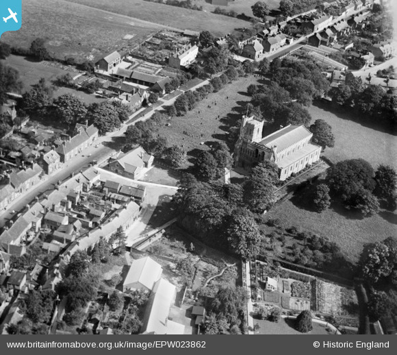
EPW023862 ENGLAND (1928). St Peter's Church and environs, Dunstable, 1928
© Hawlfraint cyfranwyr OpenStreetMap a thrwyddedwyd gan yr OpenStreetMap Foundation. 2025. Trwyddedir y gartograffeg fel CC BY-SA.
Delweddau cyfagos (9)
Manylion
| Pennawd | [EPW023862] St Peter's Church and environs, Dunstable, 1928 |
| Cyfeirnod | EPW023862 |
| Dyddiad | September-1928 |
| Dolen | |
| Enw lle | DUNSTABLE |
| Plwyf | DUNSTABLE |
| Ardal | |
| Gwlad | ENGLAND |
| Dwyreiniad / Gogleddiad | 502094, 221881 |
| Hydred / Lledred | -0.51643852306684, 51.88568895183 |
| Cyfeirnod Grid Cenedlaethol | TL021219 |
Pinnau
 melgibbs |
Saturday 11th of January 2014 06:55:16 PM |


![[EPW023862] St Peter's Church and environs, Dunstable, 1928](http://britainfromabove.org.uk/sites/all/libraries/aerofilms-images/public/100x100/EPW/023/EPW023862.jpg)
![[EPW023861] St Peter's Church and environs, Dunstable, 1928](http://britainfromabove.org.uk/sites/all/libraries/aerofilms-images/public/100x100/EPW/023/EPW023861.jpg)
![[EPW023863] The High Street and The Square, Dunstable, 1928](http://britainfromabove.org.uk/sites/all/libraries/aerofilms-images/public/100x100/EPW/023/EPW023863.jpg)
![[EPW023860] The High Street and Middle Row, Dunstable, 1928](http://britainfromabove.org.uk/sites/all/libraries/aerofilms-images/public/100x100/EPW/023/EPW023860.jpg)
![[EPW056929] The junction of West Street, Church Street and High Street North and environs, Dunstable, 1938](http://britainfromabove.org.uk/sites/all/libraries/aerofilms-images/public/100x100/EPW/056/EPW056929.jpg)
![[EPW023859] The town centre, Dunstable, 1928](http://britainfromabove.org.uk/sites/all/libraries/aerofilms-images/public/100x100/EPW/023/EPW023859.jpg)
![[EPW056927] The town centre, Dunstable, 1938](http://britainfromabove.org.uk/sites/all/libraries/aerofilms-images/public/100x100/EPW/056/EPW056927.jpg)
![[EPW014815] The town centre, Dunstable, 1926. This image has been produced from a print.](http://britainfromabove.org.uk/sites/all/libraries/aerofilms-images/public/100x100/EPW/014/EPW014815.jpg)
![[EPW056928] The junction of West Street, Church Street and High Street North, Dunstable, 1938](http://britainfromabove.org.uk/sites/all/libraries/aerofilms-images/public/100x100/EPW/056/EPW056928.jpg)