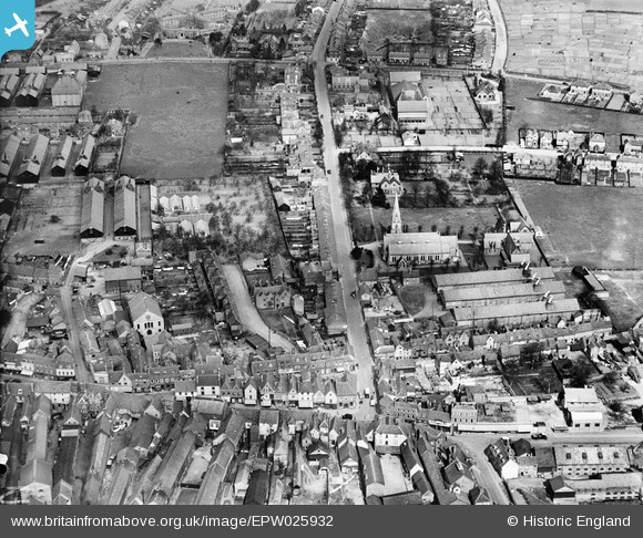
EPW025932 ENGLAND (1929). Christ Church and New Road, Ware, 1929
© Hawlfraint cyfranwyr OpenStreetMap a thrwyddedwyd gan yr OpenStreetMap Foundation. 2025. Trwyddedir y gartograffeg fel CC BY-SA.
Delweddau cyfagos (7)
Manylion
| Pennawd | [EPW025932] Christ Church and New Road, Ware, 1929 |
| Cyfeirnod | EPW025932 |
| Dyddiad | 3-April-1929 |
| Dolen | |
| Enw lle | WARE |
| Plwyf | WARE |
| Ardal | |
| Gwlad | ENGLAND |
| Dwyreiniad / Gogleddiad | 535954, 214383 |
| Hydred / Lledred | -0.027632416888223, 51.811077922538 |
| Cyfeirnod Grid Cenedlaethol | TL360144 |
Pinnau
 Colin |
Tuesday 31st of January 2017 02:47:41 PM | |
 Colin |
Tuesday 31st of January 2017 02:46:02 PM | |
 Colin |
Tuesday 31st of January 2017 02:44:51 PM | |
 John1949 |
Monday 11th of August 2014 09:40:04 AM | |
 John1949 |
Monday 11th of August 2014 09:39:20 AM | |
 John1949 |
Monday 11th of August 2014 09:38:27 AM | |
 John1949 |
Monday 11th of August 2014 09:37:26 AM | |
 John1949 |
Monday 11th of August 2014 09:33:48 AM | |
 John1949 |
Monday 11th of August 2014 09:32:12 AM | |
 John1949 |
Monday 11th of August 2014 09:31:21 AM | |
 John1949 |
Wednesday 6th of August 2014 02:18:21 PM | |
 John1949 |
Wednesday 6th of August 2014 02:17:30 PM | |
 John1949 |
Wednesday 6th of August 2014 02:16:45 PM | |
 Class31 |
Tuesday 27th of May 2014 08:25:45 AM |


![[EPW025932] Christ Church and New Road, Ware, 1929](http://britainfromabove.org.uk/sites/all/libraries/aerofilms-images/public/100x100/EPW/025/EPW025932.jpg)
![[EPW025934] Christ Church and environs, Ware, 1929](http://britainfromabove.org.uk/sites/all/libraries/aerofilms-images/public/100x100/EPW/025/EPW025934.jpg)
![[EAW022365] The town, Ware, from the south-east, 1949](http://britainfromabove.org.uk/sites/all/libraries/aerofilms-images/public/100x100/EAW/022/EAW022365.jpg)
![[EPW013338] The town centre, Ware, 1925. This image has been produced from a copy-negative.](http://britainfromabove.org.uk/sites/all/libraries/aerofilms-images/public/100x100/EPW/013/EPW013338.jpg)
![[EPW013341] Malthouses near New Road and Collett Road, Ware, 1925](http://britainfromabove.org.uk/sites/all/libraries/aerofilms-images/public/100x100/EPW/013/EPW013341.jpg)
![[EAW022367] Timber Yard off the River Lea and the town, Ware, 1949](http://britainfromabove.org.uk/sites/all/libraries/aerofilms-images/public/100x100/EAW/022/EAW022367.jpg)
![[EPW025928] Works and wharfage on the River Lee, Ware, 1929](http://britainfromabove.org.uk/sites/all/libraries/aerofilms-images/public/100x100/EPW/025/EPW025928.jpg)