
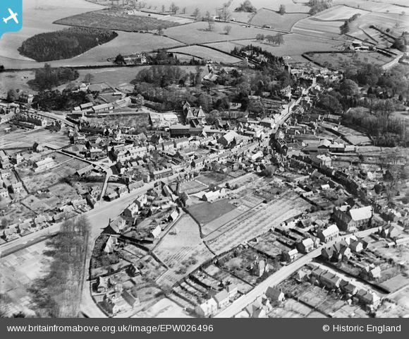
EPW026496 ENGLAND (1929). The town centre, Ampthill, 1929
© Hawlfraint cyfranwyr OpenStreetMap a thrwyddedwyd gan yr OpenStreetMap Foundation. 2025. Trwyddedir y gartograffeg fel CC BY-SA.
Delweddau cyfagos (5)
EPW026496

EAW037766

EAW037765

EPW026500

EPW026498

Manylion
| Pennawd | [EPW026496] The town centre, Ampthill, 1929 |
| Cyfeirnod | EPW026496 |
| Dyddiad | May-1929 |
| Dolen | |
| Enw lle | AMPTHILL |
| Plwyf | AMPTHILL |
| Ardal | |
| Gwlad | ENGLAND |
| Dwyreiniad / Gogleddiad | 503379, 238110 |
| Hydred / Lledred | -0.49288791083589, 52.031329728916 |
| Cyfeirnod Grid Cenedlaethol | TL034381 |
Pinnau
 SR |
Friday 19th of March 2021 09:27:29 AM | |
SR |
Friday 19th of March 2021 09:26:39 AM | |
SR |
Friday 19th of March 2021 09:26:03 AM | |
 melgibbs |
Monday 20th of January 2014 07:53:38 PM | |
Seahaze |
Monday 3rd of December 2012 01:53:49 PM |