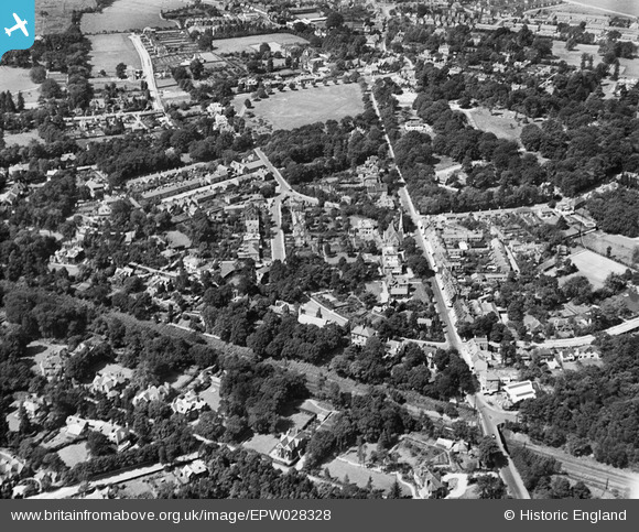
EPW028328 ENGLAND (1929). Queens Road and environs, Weybridge, 1929
© Hawlfraint cyfranwyr OpenStreetMap a thrwyddedwyd gan yr OpenStreetMap Foundation. 2025. Trwyddedir y gartograffeg fel CC BY-SA.
Manylion
| Pennawd | [EPW028328] Queens Road and environs, Weybridge, 1929 |
| Cyfeirnod | EPW028328 |
| Dyddiad | August-1929 |
| Dolen | |
| Enw lle | WEYBRIDGE |
| Plwyf | |
| Ardal | |
| Gwlad | ENGLAND |
| Dwyreiniad / Gogleddiad | 508214, 164307 |
| Hydred / Lledred | -0.44533576898728, 51.367003876155 |
| Cyfeirnod Grid Cenedlaethol | TQ082643 |
Pinnau
 richardj |
Thursday 2nd of March 2017 05:30:17 PM | |
 richardj |
Thursday 2nd of March 2017 05:22:35 PM | |
 Loopytait |
Tuesday 9th of August 2016 11:31:00 PM | |
 Loopytait |
Tuesday 9th of August 2016 11:29:24 PM | |
 mpg |
Sunday 10th of August 2014 03:22:22 PM | |
 mpg |
Sunday 10th of August 2014 03:18:16 PM | |
 mpg |
Sunday 10th of August 2014 03:17:08 PM |


![[EPW028328] Queens Road and environs, Weybridge, 1929](http://britainfromabove.org.uk/sites/all/libraries/aerofilms-images/public/100x100/EPW/028/EPW028328.jpg)
![[EPW028327] Haines Bridge and Prince's Road, Weybridge, 1929](http://britainfromabove.org.uk/sites/all/libraries/aerofilms-images/public/100x100/EPW/028/EPW028327.jpg)
![[EPW017551] Queens Road and environs, Weybridge, 1927](http://britainfromabove.org.uk/sites/all/libraries/aerofilms-images/public/100x100/EPW/017/EPW017551.jpg)
![[EPW028326] The London and Southampton Trunk Line and Oatlands Park, Weybridge, from the south-west, 1929](http://britainfromabove.org.uk/sites/all/libraries/aerofilms-images/public/100x100/EPW/028/EPW028326.jpg)