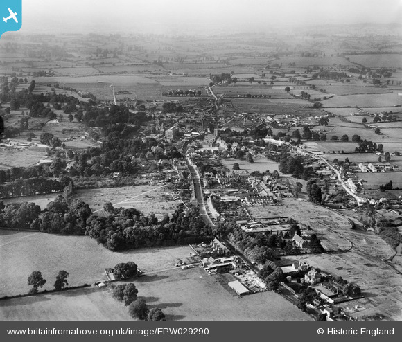
EPW029290 ENGLAND (1929). The town, Calne, from the south-east, 1929
© Hawlfraint cyfranwyr OpenStreetMap a thrwyddedwyd gan yr OpenStreetMap Foundation. 2025. Trwyddedir y gartograffeg fel CC BY-SA.
Manylion
| Pennawd | [EPW029290] The town, Calne, from the south-east, 1929 |
| Cyfeirnod | EPW029290 |
| Dyddiad | 14-September-1929 |
| Dolen | |
| Enw lle | CALNE |
| Plwyf | CALNE |
| Ardal | |
| Gwlad | ENGLAND |
| Dwyreiniad / Gogleddiad | 400171, 170215 |
| Hydred / Lledred | -1.997539981517, 51.430446900804 |
| Cyfeirnod Grid Cenedlaethol | SU002702 |
Pinnau
 Steve Bedding |
Friday 14th of June 2013 01:18:05 PM | |
 Pilot |
Sunday 28th of April 2013 07:41:54 PM |


![[EPW029290] The town, Calne, from the south-east, 1929](http://britainfromabove.org.uk/sites/all/libraries/aerofilms-images/public/100x100/EPW/029/EPW029290.jpg)
![[EPW033525] London Road and environs, Calne, from the south-east, 1930](http://britainfromabove.org.uk/sites/all/libraries/aerofilms-images/public/100x100/EPW/033/EPW033525.jpg)
![[EPW029291] The town, Calne, from the south, 1929](http://britainfromabove.org.uk/sites/all/libraries/aerofilms-images/public/100x100/EPW/029/EPW029291.jpg)