
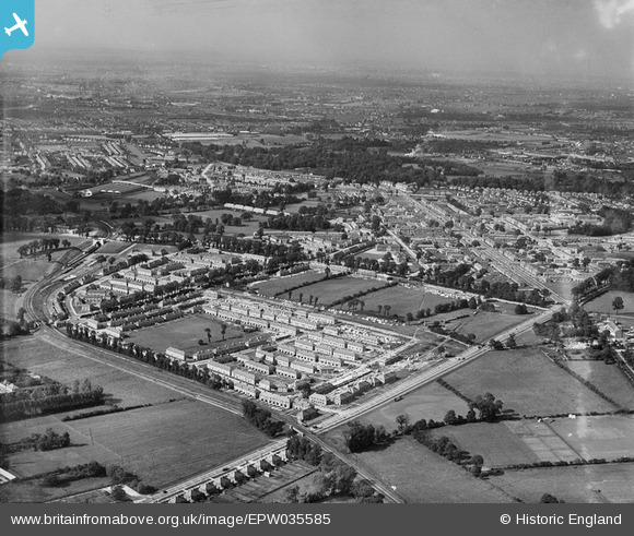
EPW035585 ENGLAND (1931). Housing surrounding Reigate Avenue, St Helier Avenue and environs, Rosehill, from the south, 1931
© Hawlfraint cyfranwyr OpenStreetMap a thrwyddedwyd gan yr OpenStreetMap Foundation. 2025. Trwyddedir y gartograffeg fel CC BY-SA.
Delweddau cyfagos (2)
EPW035585

EPW035586

Manylion
| Pennawd | [EPW035585] Housing surrounding Reigate Avenue, St Helier Avenue and environs, Rosehill, from the south, 1931 |
| Cyfeirnod | EPW035585 |
| Dyddiad | June-1931 |
| Dolen | |
| Enw lle | ROSEHILL |
| Plwyf | |
| Ardal | |
| Gwlad | ENGLAND |
| Dwyreiniad / Gogleddiad | 525665, 166491 |
| Hydred / Lledred | -0.19397666070081, 51.383040364383 |
| Cyfeirnod Grid Cenedlaethol | TQ257665 |
Pinnau
 tags66 |
Tuesday 4th of July 2017 03:09:28 PM | |
John Wass |
Tuesday 19th of May 2015 09:30:31 PM | |
christhewino |
Wednesday 12th of December 2012 03:22:19 PM | |
christhewino |
Wednesday 12th of December 2012 03:22:01 PM | |
christhewino |
Wednesday 12th of December 2012 03:21:36 PM | |
christhewino |
Wednesday 12th of December 2012 03:17:44 PM |