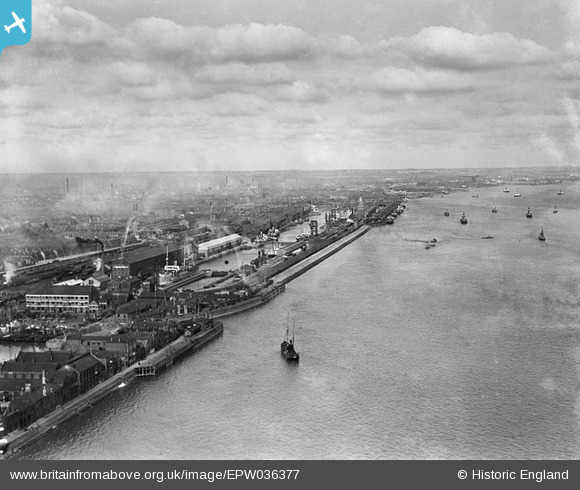
EPW036377 ENGLAND (1931). The William Wright Dock, the Albert Dock and the River Humber, Kingston upon Hull, from the south, 1931
© Hawlfraint cyfranwyr OpenStreetMap a thrwyddedwyd gan yr OpenStreetMap Foundation. 2025. Trwyddedir y gartograffeg fel CC BY-SA.
Delweddau cyfagos (5)
Manylion
| Pennawd | [EPW036377] The William Wright Dock, the Albert Dock and the River Humber, Kingston upon Hull, from the south, 1931 |
| Cyfeirnod | EPW036377 |
| Dyddiad | August-1931 |
| Dolen | |
| Enw lle | KINGSTON UPON HULL |
| Plwyf | |
| Ardal | |
| Gwlad | ENGLAND |
| Dwyreiniad / Gogleddiad | 508041, 427045 |
| Hydred / Lledred | -0.36218305687979, 53.728374767796 |
| Cyfeirnod Grid Cenedlaethol | TA080270 |
Pinnau
 John Wass |
Tuesday 4th of July 2017 03:43:23 PM |


![[EPW036377] The William Wright Dock, the Albert Dock and the River Humber, Kingston upon Hull, from the south, 1931](http://britainfromabove.org.uk/sites/all/libraries/aerofilms-images/public/100x100/EPW/036/EPW036377.jpg)
![[EPW036420] St Andrew's Dock, boats on the River Humber and environs, Kingston upon Hull, from the east, 1931](http://britainfromabove.org.uk/sites/all/libraries/aerofilms-images/public/100x100/EPW/036/EPW036420.jpg)
![[EPW036384] The Albert Dock, the William Wright Dock and the River Humber, Kingston upon Hull, from the south, 1931](http://britainfromabove.org.uk/sites/all/libraries/aerofilms-images/public/100x100/EPW/036/EPW036384.jpg)
![[EAW046148] Albert Dock West Junction and environs, Kingston upon Hull, from the south-east, 1952](http://britainfromabove.org.uk/sites/all/libraries/aerofilms-images/public/100x100/EAW/046/EAW046148.jpg)
![[EPW055049] William Wright Dock and Albert Dock, Kingston upon Hull, from the south-west, 1937. This image has been produced from a print.](http://britainfromabove.org.uk/sites/all/libraries/aerofilms-images/public/100x100/EPW/055/EPW055049.jpg)