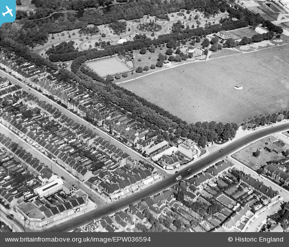
EPW036594 ENGLAND (1931). Barking Park, Barking, 1931
© Hawlfraint cyfranwyr OpenStreetMap a thrwyddedwyd gan yr OpenStreetMap Foundation. 2025. Trwyddedir y gartograffeg fel CC BY-SA.
Manylion
| Pennawd | [EPW036594] Barking Park, Barking, 1931 |
| Cyfeirnod | EPW036594 |
| Dyddiad | September-1931 |
| Dolen | |
| Enw lle | BARKING |
| Plwyf | |
| Ardal | |
| Gwlad | ENGLAND |
| Dwyreiniad / Gogleddiad | 544634, 184695 |
| Hydred / Lledred | 0.08590790777802, 51.542115809537 |
| Cyfeirnod Grid Cenedlaethol | TQ446847 |
Pinnau
 gerry |
Saturday 30th of November 2013 09:09:26 PM |


![[EPW036594] Barking Park, Barking, 1931](http://britainfromabove.org.uk/sites/all/libraries/aerofilms-images/public/100x100/EPW/036/EPW036594.jpg)
![[EPW036596] Glenny Road and environs, Barking, 1931](http://britainfromabove.org.uk/sites/all/libraries/aerofilms-images/public/100x100/EPW/036/EPW036596.jpg)
![[EPW036599] Barking Park, Barking, 1931](http://britainfromabove.org.uk/sites/all/libraries/aerofilms-images/public/100x100/EPW/036/EPW036599.jpg)