
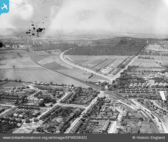
EPW038421 ENGLAND (1932). New housing site alongside Welling Way, Oxleas Wood and Bellegrove Road, Welling, from the east, 1932. This image has been produced from a damaged negative.
© Hawlfraint cyfranwyr OpenStreetMap a thrwyddedwyd gan yr OpenStreetMap Foundation. 2025. Trwyddedir y gartograffeg fel CC BY-SA.
Delweddau cyfagos (9)
EPW038421

EPW038209

EPW038190

EPW038208

EPW038423

EPW038419

EPW038191

EPW038186

EPW038418

Manylion
| Pennawd | [EPW038421] New housing site alongside Welling Way, Oxleas Wood and Bellegrove Road, Welling, from the east, 1932. This image has been produced from a damaged negative. |
| Cyfeirnod | EPW038421 |
| Dyddiad | 14-June-1932 |
| Dolen | |
| Enw lle | WELLING |
| Plwyf | |
| Ardal | |
| Gwlad | ENGLAND |
| Dwyreiniad / Gogleddiad | 545907, 175910 |
| Hydred / Lledred | 0.10061945817416, 51.462842192878 |
| Cyfeirnod Grid Cenedlaethol | TQ459759 |
Pinnau
 Steve Camp |
Tuesday 10th of September 2019 12:21:16 PM | |
Steve Camp |
Tuesday 10th of September 2019 12:20:20 PM |