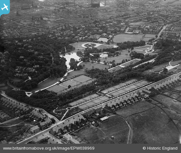
EPW038969 ENGLAND (1932). Corporation Park and environs, Blackburn, 1932
© Hawlfraint cyfranwyr OpenStreetMap a thrwyddedwyd gan yr OpenStreetMap Foundation. 2025. Trwyddedir y gartograffeg fel CC BY-SA.
Manylion
| Pennawd | [EPW038969] Corporation Park and environs, Blackburn, 1932 |
| Cyfeirnod | EPW038969 |
| Dyddiad | July-1932 |
| Dolen | |
| Enw lle | BLACKBURN |
| Plwyf | |
| Ardal | |
| Gwlad | ENGLAND |
| Dwyreiniad / Gogleddiad | 367477, 429049 |
| Hydred / Lledred | -2.4933350156782, 53.756566182442 |
| Cyfeirnod Grid Cenedlaethol | SD675290 |
Pinnau
 ewoodeddie1968 |
Monday 26th of September 2022 06:33:35 PM | |
 ewoodeddie1968 |
Monday 26th of September 2022 06:31:23 PM |


![[EPW038969] Corporation Park and environs, Blackburn, 1932](http://britainfromabove.org.uk/sites/all/libraries/aerofilms-images/public/100x100/EPW/038/EPW038969.jpg)
![[EPW038971] Corporation Park and environs, Blackburn, 1932](http://britainfromabove.org.uk/sites/all/libraries/aerofilms-images/public/100x100/EPW/038/EPW038971.jpg)
![[EPW038970] Corporation Park and environs, Blackburn, 1932](http://britainfromabove.org.uk/sites/all/libraries/aerofilms-images/public/100x100/EPW/038/EPW038970.jpg)
![[EPW038968] Corporation Park, Alexandra Meadows Cricket Ground and environs, Blackburn, 1932](http://britainfromabove.org.uk/sites/all/libraries/aerofilms-images/public/100x100/EPW/038/EPW038968.jpg)