
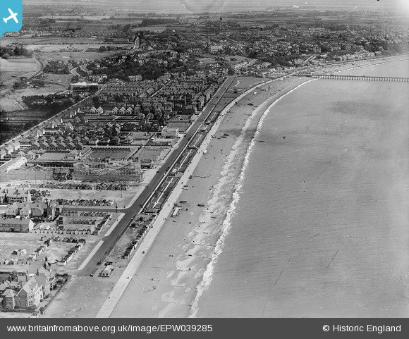
EPW039285 ENGLAND (1932). Sea Road and the town, Felixstowe, from the south-west, 1932
© Hawlfraint cyfranwyr OpenStreetMap a thrwyddedwyd gan yr OpenStreetMap Foundation. 2025. Trwyddedir y gartograffeg fel CC BY-SA.
Delweddau cyfagos (5)
EPW039285

EAW024309

EAW048299

EPW002005

EAW048294

Manylion
| Pennawd | [EPW039285] Sea Road and the town, Felixstowe, from the south-west, 1932 |
| Cyfeirnod | EPW039285 |
| Dyddiad | July-1932 |
| Dolen | |
| Enw lle | FELIXSTOWE |
| Plwyf | FELIXSTOWE |
| Ardal | |
| Gwlad | ENGLAND |
| Dwyreiniad / Gogleddiad | 629511, 233349 |
| Hydred / Lledred | 1.340290262946, 51.950763469915 |
| Cyfeirnod Grid Cenedlaethol | TM295333 |
