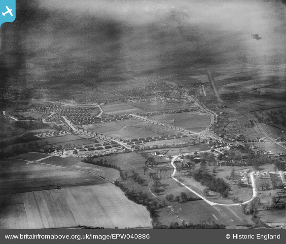
EPW040886 ENGLAND (1933). The Penhill Park Estate at Harcourt Avenue and environs, Bexley, from the east, 1933
© Hawlfraint cyfranwyr OpenStreetMap a thrwyddedwyd gan yr OpenStreetMap Foundation. 2025. Trwyddedir y gartograffeg fel CC BY-SA.
Manylion
| Pennawd | [EPW040886] The Penhill Park Estate at Harcourt Avenue and environs, Bexley, from the east, 1933 |
| Cyfeirnod | EPW040886 |
| Dyddiad | March-1933 |
| Dolen | |
| Enw lle | BEXLEY |
| Plwyf | |
| Ardal | |
| Gwlad | ENGLAND |
| Dwyreiniad / Gogleddiad | 547660, 173888 |
| Hydred / Lledred | 0.12499462926646, 51.444217035892 |
| Cyfeirnod Grid Cenedlaethol | TQ477739 |
Pinnau
 Peter |
Wednesday 4th of September 2019 11:41:58 AM |


![[EPW040886] The Penhill Park Estate at Harcourt Avenue and environs, Bexley, from the east, 1933](http://britainfromabove.org.uk/sites/all/libraries/aerofilms-images/public/100x100/EPW/040/EPW040886.jpg)
![[EPW040884] The Penhill Park Estate at Harcourt Avenue and environs, Bexley, from the south-east, 1933](http://britainfromabove.org.uk/sites/all/libraries/aerofilms-images/public/100x100/EPW/040/EPW040884.jpg)
