
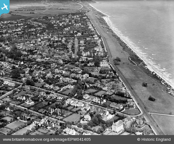
EPW041405 ENGLAND (1933). The town, Frinton-On-Sea, from the south-west, 1933
© Hawlfraint cyfranwyr OpenStreetMap a thrwyddedwyd gan yr OpenStreetMap Foundation. 2025. Trwyddedir y gartograffeg fel CC BY-SA.
Delweddau cyfagos (7)
EPW041405

EPW041406

EAW025897

EPW011634

EAW054838

EPW011635

EPW041407

Manylion
| Pennawd | [EPW041405] The town, Frinton-On-Sea, from the south-west, 1933 |
| Cyfeirnod | EPW041405 |
| Dyddiad | May-1933 |
| Dolen | |
| Enw lle | FRINTON-ON-SEA |
| Plwyf | FRINTON AND WALTON |
| Ardal | |
| Gwlad | ENGLAND |
| Dwyreiniad / Gogleddiad | 623502, 219287 |
| Hydred / Lledred | 1.2438786035075, 51.826969463949 |
| Cyfeirnod Grid Cenedlaethol | TM235193 |
Pinnau
 Onthecoast |
Wednesday 5th of June 2013 01:18:25 PM | |
It will be the Beach House or Beach Hotel which stood behind the present Rock Hotel. It was totally destroyed by a German bomb on 30th May 1943. |
 Mike from Ely |
Saturday 27th of July 2013 05:47:38 PM |
Thank you |
Onthecoast |
Monday 29th of July 2013 10:01:21 AM |
Onthecoast |
Wednesday 5th of June 2013 01:17:37 PM | |
Onthecoast |
Wednesday 5th of June 2013 01:17:02 PM |