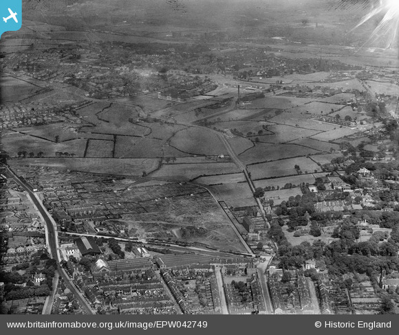
EPW042749 ENGLAND (1933). Cross Heath and May Bank, Newcastle-under-Lyme, 1933
© Hawlfraint cyfranwyr OpenStreetMap a thrwyddedwyd gan yr OpenStreetMap Foundation. 2025. Trwyddedir y gartograffeg fel CC BY-SA.
Manylion
| Pennawd | [EPW042749] Cross Heath and May Bank, Newcastle-under-Lyme, 1933 |
| Cyfeirnod | EPW042749 |
| Dyddiad | August-1933 |
| Dolen | |
| Enw lle | NEWCASTLE-UNDER-LYME |
| Plwyf | |
| Ardal | |
| Gwlad | ENGLAND |
| Dwyreiniad / Gogleddiad | 384988, 347123 |
| Hydred / Lledred | -2.2238209325819, 53.020886363455 |
| Cyfeirnod Grid Cenedlaethol | SJ850471 |
Pinnau
 ullymike |
Thursday 3rd of April 2014 03:18:07 PM | |
 ullymike |
Thursday 3rd of April 2014 03:15:48 PM | |
 bescotbeast |
Sunday 2nd of March 2014 01:51:21 AM | |
 bescotbeast |
Sunday 2nd of March 2014 01:50:42 AM | |
 bescotbeast |
Sunday 2nd of March 2014 01:50:03 AM | |
 bescotbeast |
Sunday 2nd of March 2014 01:49:20 AM | |
 bescotbeast |
Sunday 2nd of March 2014 01:45:32 AM | |
 bescotbeast |
Sunday 2nd of March 2014 01:44:43 AM | |
 bescotbeast |
Sunday 2nd of March 2014 01:44:05 AM | |
 staffsmod |
Friday 4th of October 2013 10:03:06 AM | |
 staffsmod |
Friday 4th of October 2013 10:01:20 AM | |
 staffsmod |
Friday 4th of October 2013 09:55:42 AM |


![[EPW042749] Cross Heath and May Bank, Newcastle-under-Lyme, 1933](http://britainfromabove.org.uk/sites/all/libraries/aerofilms-images/public/100x100/EPW/042/EPW042749.jpg)
![[EPW042750] Cross Heath and May Bank, Newcastle-under-Lyme, 1933](http://britainfromabove.org.uk/sites/all/libraries/aerofilms-images/public/100x100/EPW/042/EPW042750.jpg)
![[EPW042748] Cross Heath and May Bank, Newcastle-under-Lyme, 1933](http://britainfromabove.org.uk/sites/all/libraries/aerofilms-images/public/100x100/EPW/042/EPW042748.jpg)